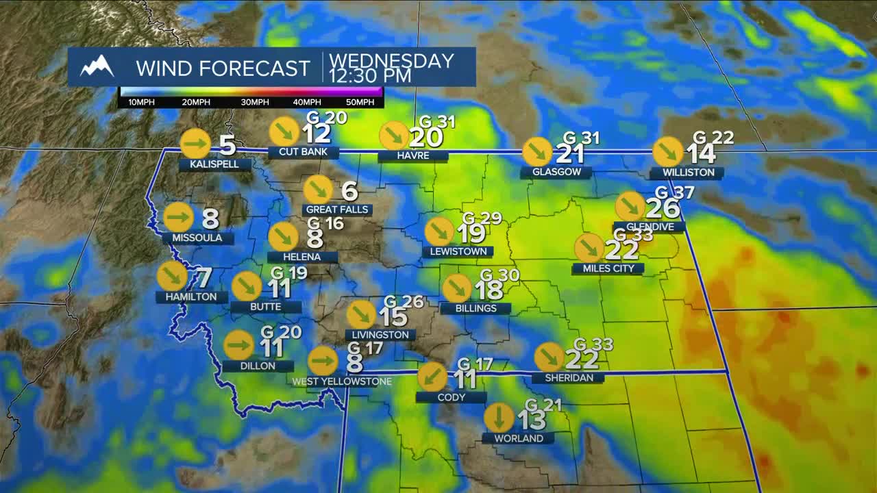


BILLINGS — Behind a cold front, northwest winds take over Wednesday, with gusts generally between 20-40 mph possible across the region, while gusts over 50 mph cannot be ruled out over eastern Montana and east of the Bighorns. A stray shower or thunderstorm will remain possible, but most of the area will stay dry.
A much more active weather pattern is setting up for the weekend as a broad upper-level low pushes out of the Pacific Northwest and rolls across southern Canada along with another disturbance that will move across the central plains. Several models are hinting at the potential for measurable rainfall in areas east of Billings (over .25") and possible severe thunderstorms, but that risk is low for now. Keep a close eye on the forecast over the next few days, especially if you have outdoor plans for later Saturday into Sunday.
Daytime highs will be in the upper 60s west to mid-70s on Wednesday, mid to upper 70s on Thursday, upper 70s to low 80s on Friday and Saturday, then mid to upper 70s on Sunday.
Miller Robson
Q2 Morning Meteorologist
miller.robson@ktvq.com
