

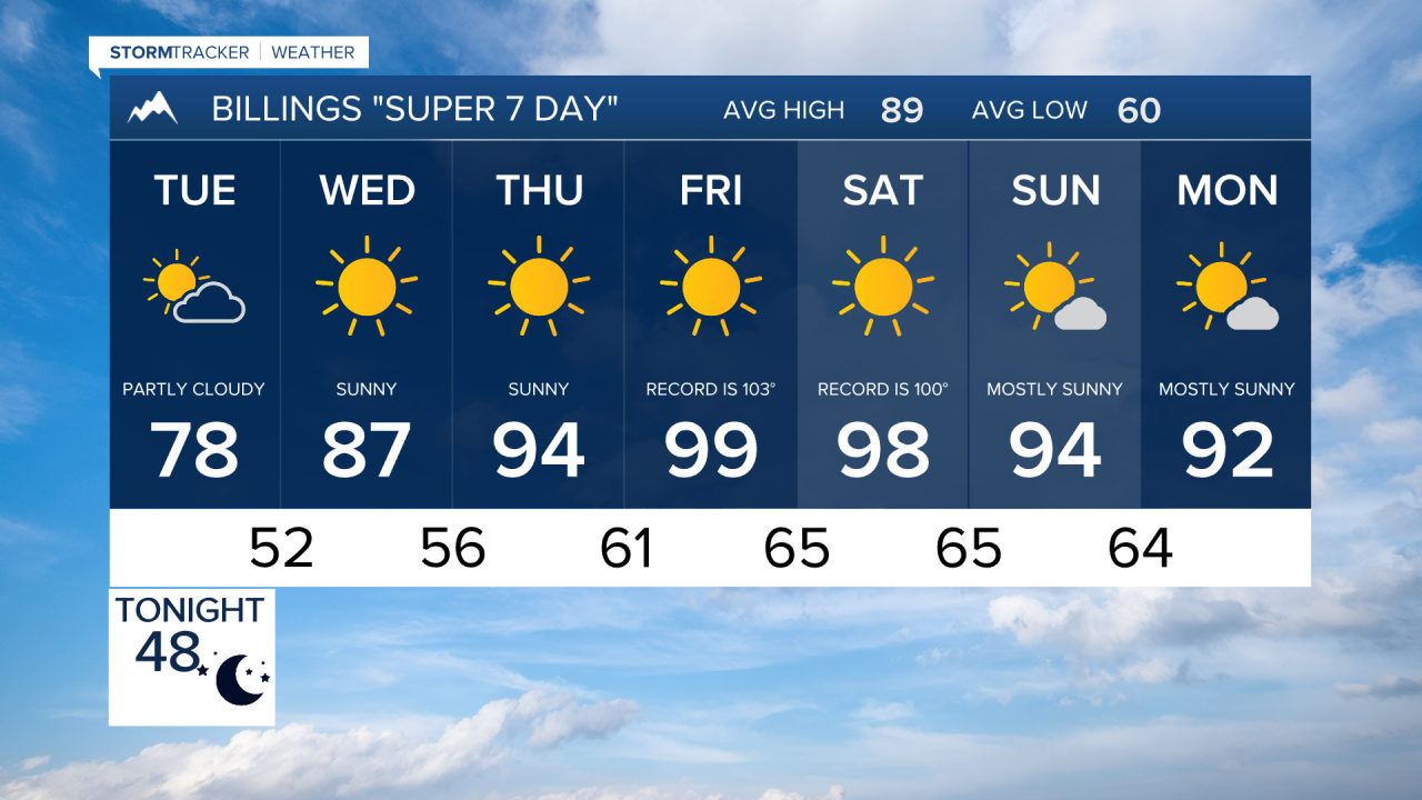


BILLINGS — Much cooler air has settled into south central and southeast Montana. By morning, we will be close to record cold lows for August 4. Just a handful of days later, high temperatures may approach 100 degrees again by Friday, and Saturday looks to be close to record hot temperatures.
MONDAY NIGHT
Wildfire smoke will continue to gradually improve through the evening and overnight as a weather system exits the region and cleaner air filters in. A few showers and isolated weak thunderstorms will linger mainly north and east of Billings before ending. Mostly clear skies and light winds will allow temperatures to fall into the 40s and lower 50s by daybreak.
TUESDAY
A cool August day is expected with highs in the mid to upper 70s. Some locations may come close to daily record low temperatures early in the morning. Most areas will remain dry, though a weak disturbance could trigger a few isolated showers or weak thunderstorms near the Montana-Wyoming border during the afternoon and evening.
WEDNESDAY
A strengthening ridge of high pressure will bring sunshine, dry conditions, and a warming trend across the region. Temperatures will climb back into the 80s and lower 90s.
THURSDAY
Dry weather continues with abundant sunshine and increasingly hot temperatures. Afternoon highs will rise well above seasonal averages as the ridge strengthens over the Northern Rockies.
FRIDAY
The hottest day of the week is expected, with many lower elevation locations approaching or reaching 100 degrees. Dry conditions will persist, increasing heat impacts and drying fuels across the area.
SATURDAY
Very warm to hot weather continues, though temperatures may ease slightly from Friday's peak. Conditions remain predominantly dry under lingering high pressure.
SUNDAY
A gradual cooling trend begins as the ridge weakens. Highs will trend back toward the upper 80s and lower 90s. Moisture may begin increasing late in the day, bringing a slight chance of afternoon or evening thunderstorms.
MONDAY
Temperatures remain closer to seasonal normals with highs generally in the upper 80s to lower 90s. Increasing moisture will support scattered afternoon and evening thunderstorms, with chances ranging from 20 to 50 percent across the area.
