

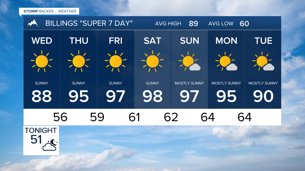


BILLINGS — A stretch of hotter weather is on the way for southern Montana, while wildfire smoke continues to create hazy skies and periodic air quality concerns. Fire weather conditions will become increasingly elevated late this week as temperatures climb into the 90s and winds turn breezy at times.
TUESDAY NIGHT
A weak disturbance moving through the region may spark a few isolated showers or weak thunderstorms over the Beartooth/Absaroka and Bighorn Mountains, with a slight chance of activity drifting into areas near the Montana-Wyoming border overnight. Most lower elevations will remain dry. Wildfire smoke will continue to produce hazy skies across much of southern Montana.
WEDNESDAY
A building ridge of high pressure brings dry weather and warmer temperatures. Highs will climb into the 80s across the region under mostly sunny skies. Smoke and haze may linger at times, especially during the morning and evening hours.
THURSDAY
The warming trend continues as highs reach the 90s. A mostly dry cold front approaches, and breezy winds may develop during the afternoon or evening. Wind gusts of 20 to 30 mph are possible, helping to increase fire weather concerns as hot, dry conditions persist.
FRIDAY
Temperatures remain hot, generally in the 90s, despite the passage of the dry front. Breezy conditions may continue, keeping fire weather concerns elevated. Skies will remain mostly dry, with smoke potentially becoming more noticeable as upper-level winds shift to a more westerly direction.
SATURDAY
The hottest day of the period is expected, with many locations reaching the mid to upper 90s and a few spots nearing 100 degrees. Dry conditions continue, and periods of gusty winds could further heighten fire danger. Anyone spending time outdoors should use caution with activities that could create sparks.
SUNDAY
Temperatures remain very warm, though the ridge begins to weaken. Highs stay in the 90s for many areas, with continued dry weather and occasional breezy periods. Smoke may continue to affect visibility and air quality at times.
MONDAY
A gradual cooling trend begins, with highs falling back into the upper 80s and lower 90s. Increasing monsoonal moisture and weak disturbances may bring scattered afternoon and evening showers and thunderstorms, with chances ranging from 20 to 50 percent. This pattern could continue into early next week.
