



BILLINGS — Hot temperatures are expected to stick around through the week, with highs mainly in the 80s and 90s before cooler weather returns this weekend, with highs mainly be in the 70s and 80s, though some locations could dip into the 60s. Areas in northeast MT could crack 100° on Tuesday. so a Heat Advisory will be in effect. The warm stretch will continue to accelerate mountain snowmelt, leading to rising water levels on area rivers and streams. Flooding is not expected at this time, but fast-moving currents, strong stream flow, and very cold water temperatures could create dangerous conditions for anyone recreating near or in waterways.
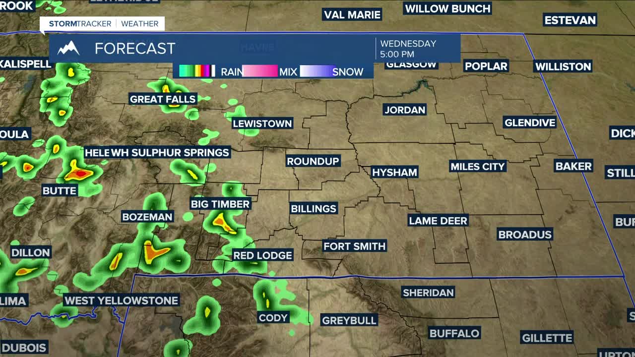
Daily chances for showers and thunderstorms are expected through the week, especially across south-central and western Montana and north-central and western Wyoming. Most of the activity through Thursday is expected to remain isolated to scattered, so not everyone will see rain, and amounts will generally remain light. By Friday and into the weekend, the overall pattern could support more widespread precipitation and thunderstorms, although there is still some uncertainty regarding how the setup will fully evolve.
An approaching trough and associated front will bring an increased chance for scattered showers and thunderstorms on Tuesday, mainly west of Billings, with a few isolated storms possible across eastern Montana and north-central Wyoming. Forecast conditions suggest there will be enough instability for a few storms to become strong or even severe. Any storms that develop could produce erratic wind gusts up to 60 mph, brief moderate to heavy rainfall, and dime-sized hail.
Wednesday and Thursday are trending somewhat drier behind the trough, though isolated to scattered afternoon and evening storms are still expected, especially west of Billings.
Looking ahead to Friday and Saturday, forecast models continue to indicate a more active weather pattern developing across the region. This could lead to more widespread showers and thunderstorms, including the potential for a few strong to severe storms. The exact timing and placement remain uncertain. Unsettled weather may linger into the latter part of the weekend, although the threat for widespread rain and stronger storms currently appears lower by Sunday.
Strong southeasterly winds are expected to impact the region at times through the weekend, with gusts between 20 and 40 mph possible. The strongest winds are expected near the Montana and Dakotas state line.
Miller Robson
Q2 Morning Meteorologist
miller.robson@ktvq.com
