


BILLINGS — Some areas could wake up to patchy fog Tuesday morning, especially from Broadus down to Sheridan, WY.
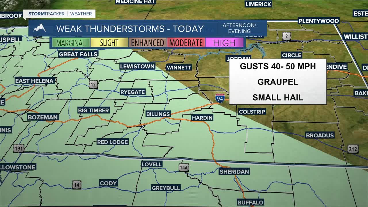
The region will remain under the influence of northwest flow Tuesday and Wednesday, keeping a chance of lower-elevation rain in the forecast. As temperatures get warmer, with daytime highs ranging in the mid to upper 50s on Tuesday, then upper 50s to low 60s on Wednesday, there could be enough instability to produce isolated weak thunderstorms with brief gusty winds between 40–50 mph. Graupel or even small hail could be possible with any storms that do pop up.
While rain is expected in lower locations (some snow could mix in Tuesday evening), it will be all snow in the mountains, where a few inches could fall over the next few days.
From Thursday into Friday, an upper-level ridge will move into the region, bringing warmer and drier conditions for the most part, although a weak disturbance within the northwest flow may still kick up a few isolated light showers near the mountains and foothills on Thursday. It will continue to get warmer, with some areas (including Billings) reaching into the low 70s Friday and Saturday.
The forecast becomes less certain this weekend due to differences in how the upper-level ridge is expected to weaken, influenced by low-pressure systems to the southwest and northeast. However, the ridge is still anticipated to break down eventually, bringing back a chance of precipitation. If you have outdoor or travel plans, it’s a good idea to keep an eye on the forecast.
Miller Robson
Q2 Morning Meteorologist
miller.robson@ktvq.com
