


BILLINGS — Strong winds will persist across the western foothills on Wednesday, with gusts between 50–65 mph expected, while widespread gusts generally between 30–40 mph will impact the rest of the region. Strong winds will persist over the western foothills Thursday through Saturday, with daily gusts over 50 mph expected, while breezy conditions remain for the rest of the region.
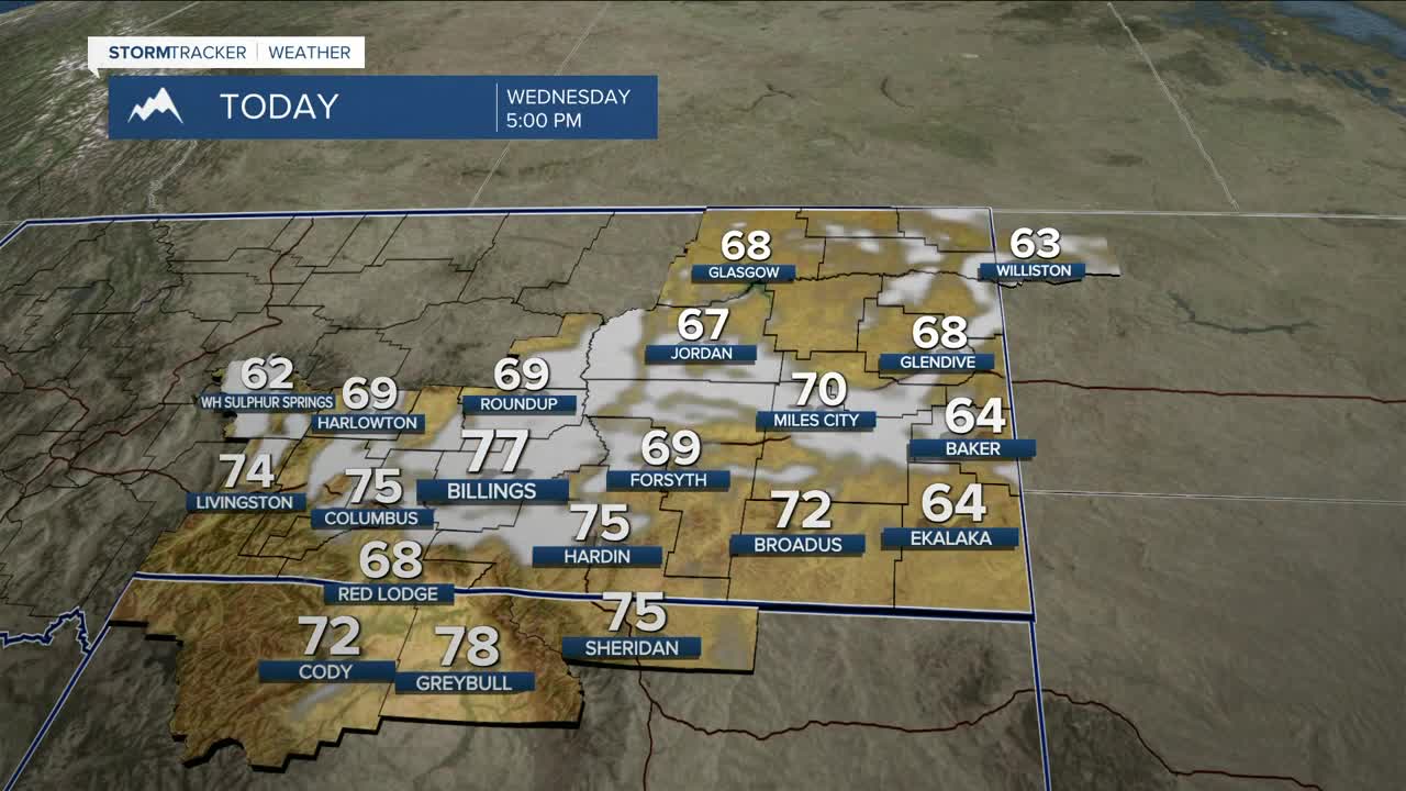
High pressure will continue to build over the area, bringing mainly dry conditions through Friday as temperatures continue to rise. Highs will be in the 60s and 70s on Wednesday and Thursday, then mainly in the 70s on Friday, but some locations could crack 80 degrees on Thursday and Friday. Record highs will be within reach over the next three days.
With these warmer temperatures, the snow is melting rapidly, but there is little to no risk of flooding, although there will be a moderate rise in streams, creeks, and rivers.
Some models suggest that an upper-level disturbance will move through over the weekend, bringing cooler—but still warmer-than-average—temperatures, along with a slight chance of rain. There is still some uncertainty with this.
Miller Robson
Q2 Morning Meteorologist
miller.robson@ktvq.com
