

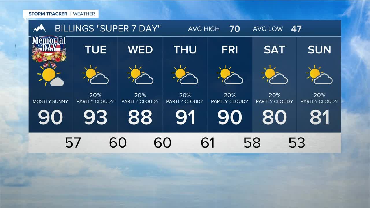


BILLINGS — Warm to hot weather is expected through the first half of the week, with highs mainly in the mid-80s to low 90s on Monday and Tuesday. As a result, some locations will have a good chance to tie or break record highs. Temperatures will stay warmer-than-normal for the rest of the week, but will try to down some for the weekend.
The prolonged warmth will accelerate mountain snowmelt, leading to increased flows on streams and rivers throughout the week. Flooding is not anticipated at this time, but swift currents and very cold water could create dangerous conditions for anyone spending time near waterways.
The week will begin with mainly dry conditions across much of the area, but a few showers and isolated weak thunderstorms are possible in and near the mountains on Monday, mainly west and south of Yellowstone County. The main concerns with any storms that do develop will be brief gusty winds up to 50 mph.
A large low-pressure system is forecast to influence the area from Tuesday through Thursday, keeping an unsettled weather pattern in place and allowing for daily chances of showers and thunderstorms across much of the region. Confidence is growing that there will be ample atmospheric moisture from Tuesday through the weekend, but rainfall totals will depend of the evolution of the system ,which could lead to more widespread rainfall chances. However, because the showers will be scattered, rainfall amounts will likely differ significantly between locations.
There is still some uncertainty regarding how the forecast will evolve by Friday and Saturday, but model trends suggest another low-pressure system and cold front could affect the region, keeping daily chances for showers and thunderstorms in the forecast through the weekend. Some storms could become strong or even severe. We'll have a better understanding as we get closer to the end of the week, so stay tuned.
Along with the precipitation chances, southeasterly winds across southeastern Montana are expected to become breezy at times from Tuesday through the latter half of the week, with gusts generally ranging from 20 to 40 mph. The strongest gusts are most likely to occur on Wednesday.
Nightly lows will be mainly in the 50s and 60s for the week.
Miller Robson
Q2 Morning Meteorologist
miller.robson@ktvq.com
