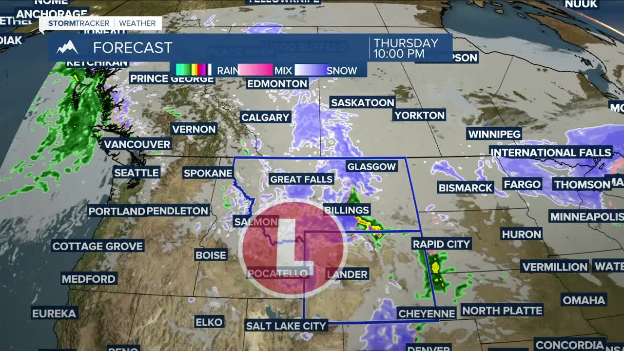


BILLINGS — We continue to track an upper-level low that is forecast to slide across southern MT and WY Thursday into Friday, bringing heavy, wet snow to the mountains, foothills, and in some lower-elevation locations, along with breezy to windy conditions.
It will be all snow from the get-go in the mountains, but will start as rain in the lower elevations Thursday afternoon before turning to all snow by late Thursday night or early Friday morning. There could be just enough instability for a few rumbles of thunder or even a weak thunderstorm or two during the afternoon or evening, but that chance is on the low end at the moment.
Winter Weather Warnings and Advisories will be in effect for much of the region Thursday through Friday, with generally between 1–8" possible in the lower elevations, especially in the higher hills. Mountain areas could get well over a foot. Be prepared for wintry travel conditions in areas that do see snow. Watch out for slick roads/sidewalks and blowing/drifting snow that could cause reduced visibility. Turn on those headlights!
Here are some projected snow totals using a blend of models. This is all dependent on the track of the winter system, so some areas show a wider range of possibilities:
Billings, MT: 0–2"
Alzada, MT: 2–8"
Baker, MT: 2–7"
Big Timber, MT: T–1"
Broadus, MT: 1–6"
Burgess Junction, WY: 5–15"
Clearmont, WY: 1–7"
Columbus, MT: 0–1"
Cooke City, MT: 3–9"
Crow Agency, MT: 0.5–6"
Daisy Pass, MT: 4–11"
Dayton, WY: 1–8"
Ekalaka, MT: 2–8"
Forsyth, MT: 0.5–4"
Gardiner, MT: 0.5–5"
Harlowton, MT: T–1"
Hardin, MT: 1-4"
Hysham, MT: 0–3"
Lame Deer, MT: 1–6"
Livingston, MT: 0.5–5"
Lodge Grass, MT: 1–6"
Miles City, MT: 0.5–4"
Ranchester, WY: 1–7"
Red Lodge, MT: 0.5–3"
Roundup, MT: 0–1"
Sheridan, WY: 1–6"
In terms of total moisture (rain and snow), much of the area could get over a quarter of an inch, while locations in south-central and eastern MT and northern WY could receive up to a half an inch or more.
As for the wind, expect breezy northwest winds across much of the region Thursday afternoon into Friday, with gusts generally between 25 to 45 mph, but there is potential for gusts over 50, especially over the Bighorn foothills Friday morning into afternoon.
It will turn briefly colder on Friday, with highs in the 30s and 40s. This, combined with heavy, wet snow, will be hazardous for young livestock.
The system is expected to exit by late Friday into early Saturday morning, with high pressure bringing dry and warmer conditions in for what should be a pleasant Easter weekend. Daytime highs will be in the 50s and 60s.
Miller Robson
Q2 Morning Meteorologist
miller.robson@ktvq.com
