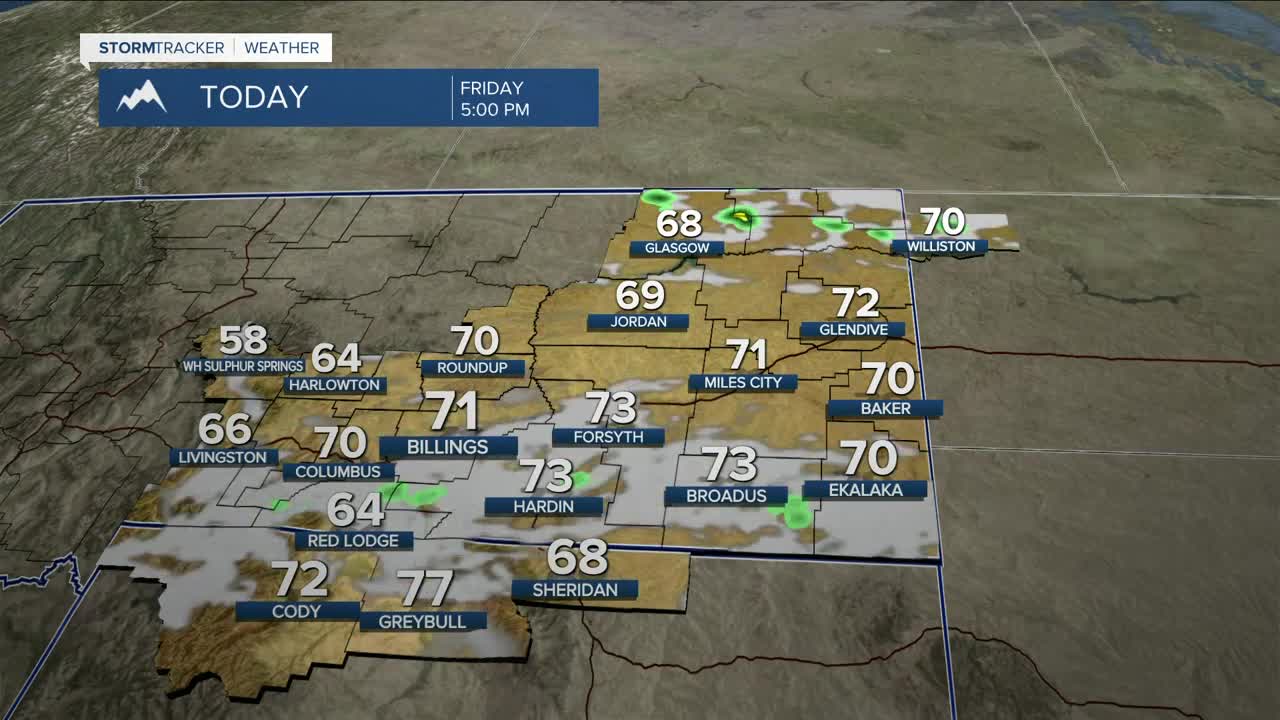


BILLINGS — The region will be under the influence of zonal flow on Friday, so it will remain breezy to windy, but to a slightly lesser extent, with gusts between 25-40 mph across the area before finally easing up by the evening. After some light rain in the morning, mainly to the east, it will stay dry, with humidity levels staying near what we saw on Thursday, but a weak shortwave could bring a few showers or even flurries over the western mountains. However, precipitation could evaporate before hitting the ground. Daytime highs will be in the mid-60s to low 70s.
Saturday starts off dry, with highs in the mid-60s to mid-70s ahead of the next weather system that will potentially bring a much better chance of meaningful precipitation that the area desperately needs. It will also bring cooler temperatures Saturday night through Monday.
Confidence is growing for over 6 inches of snow accumulating in all area mountains. The foothills could pick up a few inches of wet snow. A few models are even hinting at the possibility of some wet snow in Billings on Monday morning. The colder temperatures and snowfall will help alleviate the mountain snowmelt and allow river flows to slow a bit.
In terms of moisture from the rain and snow, current projections indicate totals generally ranging from .25-.50" across the region, with over 1" in the mountains. While forecast confidence is increasing, there is still some uncertainty regarding how the system will ultimately develop, and the projections could absolutely change. Continue to monitor the forecast for the latest updates, and we’ll keep you informed.
There is uncertainty on whether the weather will stay unsettled into the first half of next week, but some models are indicating that a weak shortwave could still bring the opportunity for showers.
Expect highs mainly in the 40s and 50s on Sunday, 30s and 40s on Monday, followed by a warming trend into the 60s and lower 70s by the middle of next week.
Miller Robson
Q2 Morning Meteorologist
miller.robson@ktvq.com
