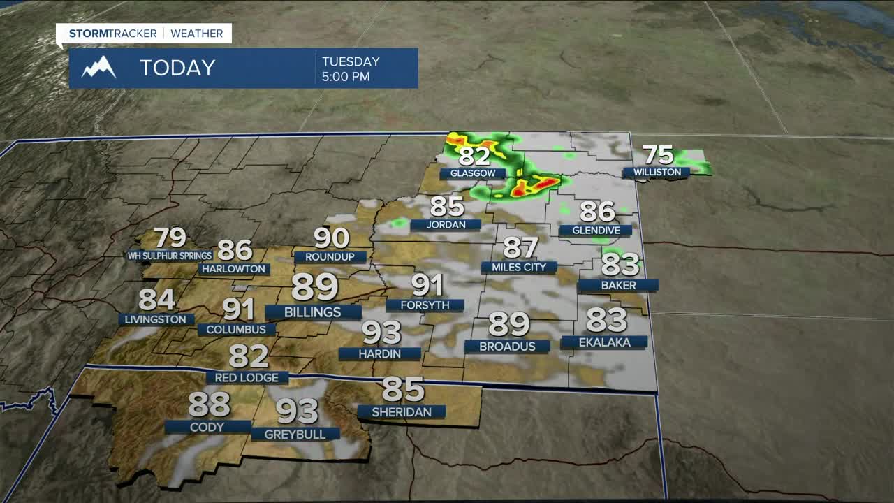


BILLINGS — Expect warm, dry, and breezy conditions on Tuesday ahead of a stronger disturbance, along with a cold front, that will drop down into the region from the north Tuesday night into Wednesday. Ahead of this, winds will increase across the area on Tuesday, with gusts from the west between 40-55 mph along the western foothills by the afternoon, while gusts between 30-40 mph will be possible across the rest of the region. Daytime highs will reach into the mid to upper 80s, with a few locations pushing into the low 90s. While recent rainfall and green-up should limit widespread fire weather concerns, some areas have received less precipitation and could see locally elevated fire danger. Use caution to avoid causing sparks. There is a chance for showers and thunderstorms mainly to the east and northeast on Tuesday. Northeast MT has a Marginal Risk (1 of 5) for severe thunderstorms Tuesday evening.
As the approaching shortwave and cold front move through the region Tuesday night into Wednesday, breezy northwest winds will develop across the area, with gusts between 25-40 mph expected for many locations, the strongest winds being over far eastern MT and along the east side of the Bighorns, where gusts between 40-50 mph are possible.
Chances for showers and thunderstorms will increase behind the front across northern and eastern areas Wednesday, with probabilities ranging from 15% to 50%. Increasing instability could support a few stronger storms across northeast MT, while weaker thunderstorms are expected farther south into the southeast portion of the state. Daytime temperatures will be cooler Wednesday, about 10 to 20 degrees lower than Tuesday, with afternoon highs mainly in the 60s and 70s.
Northwest flow is expected to remain in place through Friday, with weak disturbances bringing periodic isolated showers and thunderstorms, mainly along the edges of the forecast area.
Heading into the weekend, models continue to suggest southwest flow developing across the northern Rockies as an upper-level trough moves into the western U.S. This pattern would support a better chance for showers and thunderstorms as additional disturbances move through the region and moisture increases across the plains. Keep an eye on the forecast if you have any weekend outdoor plans.
Daytime highs are expected to be mainly in the 70s most days Thursday through Sunday.
Miller Robson
Q2 Morning Meteorologist
miller.robson@ktvq.com
