


BILLINGS — High pressure continues building across the region Wednesday as the ridge shifts east and a trough approaches. That setup will help temperatures soar into the upper 80s and lower to mid 90s, making this the warmest day of 2026 so far. A few record highs could be challenged.
South winds will increase at times, especially across the western valleys and far eastern Montana, with gusts generally in the 20-30 mph range. Humidity drops into the teens for many locations, though the far east may stay a bit higher near 20%. Green-up is helping lower elevations, but with the warm, dry, and breezy conditions, any fire start could spread quickly. Use caution with anything that could create sparks.
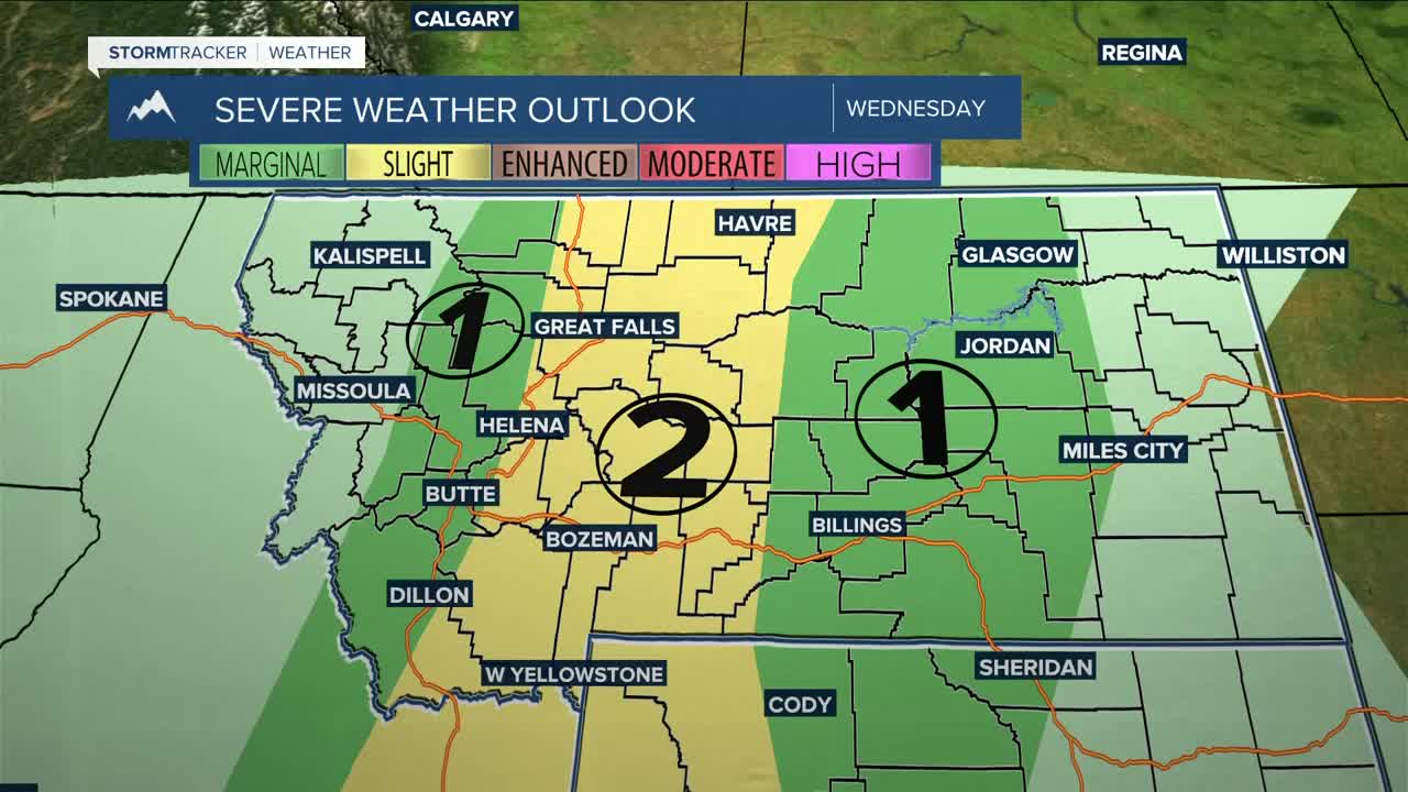
By Wednesday afternoon and evening, the incoming trough will bring a chance for isolated to scattered showers and thunderstorms across western Montana before activity spreads east Wednesday night. The main concern with any storms will be strong and erratic wind gusts due to modest instability and dry air in place. Some storms may produce gusts over 45-55 mph, even without much rainfall.
A cold front arriving later Wednesday evening could combine with thunderstorm outflows to create a burst of stronger winds. Widespread gusts between 25-45 mph are expected, with locally stronger gusts possible.
Strong west winds then develop Wednesday night into Thursday as the system lifts into southern Canada. Confidence remains high for impactful winds, especially from Roundup to Billings and westward. Gusts of 40-65 mph appear likely, with isolated gusts near 70 mph possible along the western foothills. Travel could become difficult at times, especially along US-191 from Big Timber to Judith Gap, and isolated tree or power line damage can’t be ruled out if stronger winds develop.
Thursday and Friday turn much cooler, with highs mainly in the 60s and 70s, but conditions stay very dry with low humidity. Thursday looks to be the biggest fire weather concern because of the strong winds, although ongoing green-up should help limit widespread critical fire danger.
Looking ahead to the weekend and early next week, another stronger system may move in from the Pacific Northwest, bringing increasing chances for rain and mountain snow from late weekend into Monday. Some areas could pick up meaningful precipitation, especially across the foothills and mountains, with accumulating mountain snow possible. High temperatures may fall back into the 50s and lower 60s by Sunday and Monday, and the unsettled pattern could continue into next week.
Miller Robson
Q2 Morning Meteorologist
miller.robson@ktvq.com
