


BILLINGS — The first week of June will see the region remain under the influence of an unstable weather, with daily scattered showers and thunderstorms possible.
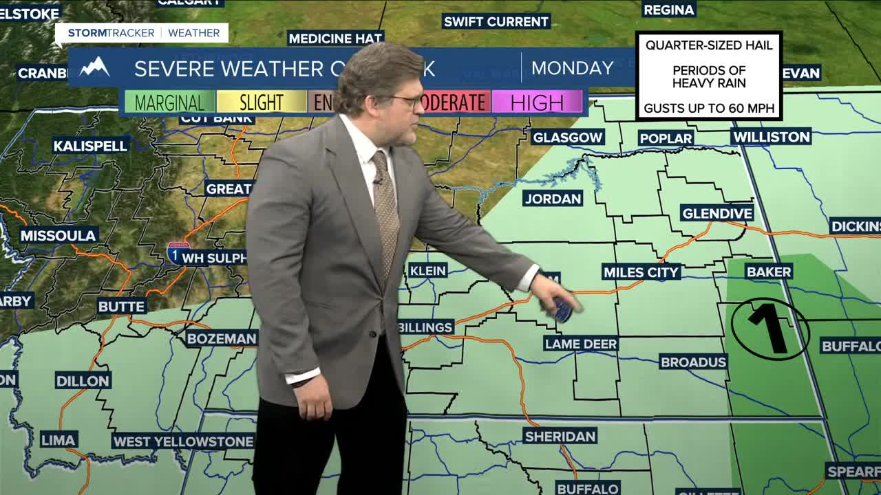
A disturbance lifting through the area will bring a chance of showers and thunderstorms Monday afternoon and evening. While just general thunderstorms are anticipated for much of the area, there could be just enough instability for a few strong or severe storms across southeast MT, mainly in Powder River and Carter counties. Something to keep an eye on. Daytime highs will be in the mid-60s west to low 70s east.
Cyclonic flow from low pressure over southern Saskatchewan will keep a low-end chance for showers and thunderstorms in the forecast on Tuesday and Wednesday. There could be a few severe storms in far eastern MT on Tuesday, but Wednesday looks to be more stable. Highs will generally be in the low to mid-70s both days.
Thursday could be more active as another Pacific wave is forecast to move in. Several models are suggesting a better chance for severe storms that day. Daytime temperatures will be in the mid-70s west to low 80s east.
Friday is shaping up to be mostly dry and warmer, with highs in the upper 70s to mid-80s.
Thunderstorm chances are expected to return over the weekend as energy from another trough moves into the region, potentially bringing strong to severe thunderstorms. Weekend highs will be in the mainly in the 80s.
Miller Robson
Q2 Morning Meteorologist
miller.robson@ktvq.com
