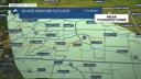


BILLINGS — A wave dropping through will influence the region on Tuesday, with a chance for more precipitation. The Beartooths/Absarokas could receive between 3–6 inches of snow over the next 24 hours, especially on the highest north-facing slopes. Over a quarter inch of moisture is likely. Don't be surprised if you hear a rumble of thunder. The foothills and higher hills southwest of Billings have a very good chance of seeing a rain/snow mix, possibly even turning to all snow, with a few inches possible. Isolated to scattered showers will spread across the lower elevations, but not much accumulation is expected.
High pressure ridging will briefly bring dry conditions on Wednesday, ahead of several disturbances that will bring a chance for daily showers from Thursday through Saturday. There could be just enough instability to produce weak afternoon thunderstorms during that three-day period.
Daytime highs will remain on the cool side on Tuesday, with temperatures in the mid-40s to low 50s, but will gradually warm into the mid-50s to low 60s on Wednesday, mid-to-upper 60s on Thursday, then the 60s and some 70s from Friday through the weekend.
Lows will be in the mid-20s to mid-30s Tuesday morning, and especially Wednesday morning, so be sure to protect plants, sensitive vegetation, pets, and young livestock.
Miller Robson
Q2 Morning Meteorologist
miller.robson@ktvq.com
