



BILLINGS — It will be another warm to hot day across the area, with daytime highs in the upper 80s to mid-90s on Friday, the warmest temperatures mainly over the east.
Isolated to scattered showers and thunderstorms remain possible on Friday, again mostly over the mountains and areas west of Billings. Instability will ramp up a bit, so some storms could turn strong and produce gusty and erratic winds up to 60 mph, quarter-sized hail, and brief downpours. There is a Marginal Risk (1 of 5) west-northwest of Yellowstone County.
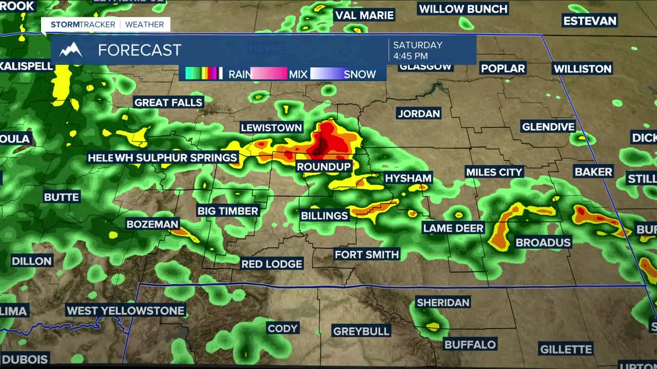
A better chance for rain comes this weekend, as models are forecasting that an upper low that has been stalled to our southwest will finally lift north and east into Wyoming by Saturday, bringing a very good opportunity for widespread showers and thunderstorms across the region. Increasing instability could spawn a few strong to severe thunderstorms across southeastern MT and northeastern WY, where a Marginal Risk will bring the possibility of strong wind gusts, hail, and heavy downpours.
In terms of rain totals, there is a moderate to high chance of at least a half inch accumulating, with the highest amounts across western and central Montana. An inch or more is also possible, especially in our western zones, but to a lesser extent. The overall flooding threat remains low for now, though localized flooding concerns could develop in areas hit by heavier thunderstorms, especially near recent burn scars.
Here are the potential rainfall totals using a blend of models. Keep in mind, these numbers are dependent on the track and strength of the system and could (and probably will) change.
Billings, MT — 1.4"
Alzada, MT — 0.5"
Baker, MT — 0.5"
Big Timber, MT — 1.4"
Broadus, MT — 0.7"
Burgess Junction, WY — 1.2"
Clearmont, WY — 0.6"
Cody, WY — 1"
Columbus, MT — 1.2"
Cooke City, MT — 1.2"
Crow Agency, MT — 1.2"
Daisy Pass, MT — 1.3"
Dayton, WY — 0.9"
Ekalaka, MT — 0.6"
Forsyth, MT — 0.9"
Gardiner, MT — 1.1"
Hardin, MT — 1.2"
Harlowton, MT — 1.2"
Hysham, MT — 1.0"
Lame Deer, MT — 0.8"
Livingston, MT — 1.8"
Lodge Grass, MT — 1.0"
Miles City, MT — 0.8"
Ranchester, WY — 0.8"
Red Lodge, MT — 1.4"
Roundup, MT — 1.3"
Sheridan, WY — 0.7"
While it will be all rain in the lower elevations, the mountains will get snow, with levels expected to drop to near 9,000 feet. Several inches will be possible over the highest peaks, including parts of the Beartooth Highway.
A cold front will cool daytime temperatures down into the upper 60s west to 80s east on Saturday, 50s west to 70s east on Sunday, before gradually warming into the 80s by the middle of next week.
Miller Robson
Q2 Morning Meteorologist
miller.robson@ktvq.com
