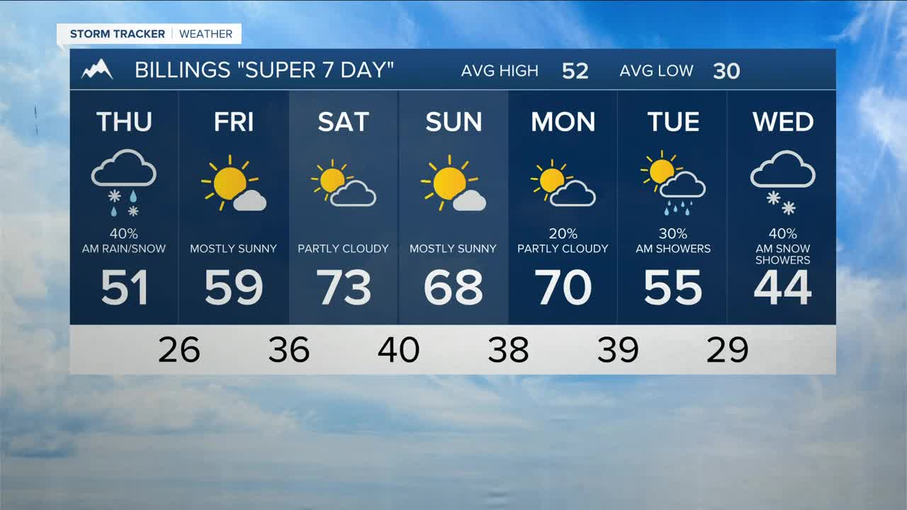


BILLINGS — Thursday starts off in the wake of a cold front and a secondary wave from the north, bringing a chance of a few inches of mountain snow and light lower-elevation rain with some wet snow mixing in through early afternoon. It will also be much cooler, with highs in the upper 30s to low 50s, and gusty northwest winds between 30 to 40 mph (stronger at times across the western foothills) during the afternoon.
High pressure brings warmer and drier conditions Friday through the weekend, with highs mainly in the 50s on Friday then 60s and 70s on Sunday and Monday. A weak backdoor cold front dropping down from the north could knock daytime highs down a few degrees both days.
Winds should be on the light side for much of the weekend, but could increase across the western foothills Sunday into Monday as some models are showing another trough moving toward the region that could bring cooler temperatures and more precipitation by early next week. Stay tuned.
Miller Robson
Q2 Morning Meteorologist
miller.robson@ktvq.com
