

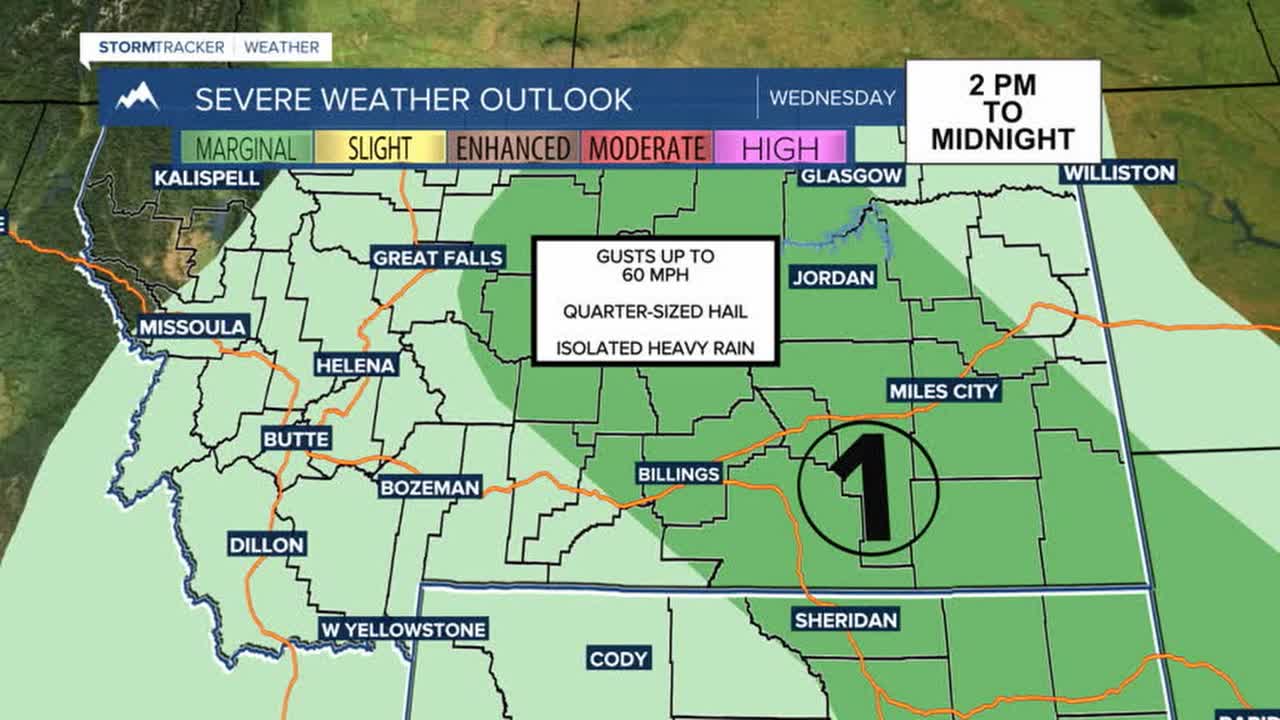


BILLINGS — A weak shortwave will keep chances for showers and thunderstorms in the forecast Wednesday afternoon into the evening as temperatures get warmer. There is a MARGINAL RISK (1 out of 5) for severe storms across a good portion of the region, with gusts up to 60 mph and quarter-sized hail the main concerns. Isolated heavy rainfall will also be possible, especially in southeast MT/northeast WY. Daytime highs will be mainly in the upper 80s to low 90s.
Thursday looks to be mostly dry as drier air moves into the region, but daytime heating will keep a decent chance for a few afternoon showers and isolated thunderstorms across eastern MT. Daytime temperatures will again be mainly in the upper 80s to low 90s.
The big weather story heading into the weekend will be the incoming wave of extreme heat that will blanket the region, with some locations vying for all-time record high temperatures on Sunday. Here are some of those records that could be within reach:
Billings - 108°
Livingston - 105°
Miles City - 111°
Sheridan - 107°
Baker - 109°
Friday kicks things off with daytime highs mainly in the mid to upper 90s before pushing into the upper 90s to low 100s on Saturday and Sunday as conditions stay dry. This will heighten wildfire and grassfire concerns.
Monday may cool slightly, but it will still be very hot, with highs in the mid-90s to low 100s.
Overnight temperatures will also be warmer than normal, with lows in the 60s and 70s, so there will not be much opportunity to cool down.
Something worth watching is wildfire smoke. If enough drifts overhead, it could slightly suppress daytime highs. Nonetheless, dangerous heat is heading our way, so prepare now for ways to stay cool.
Next week aims to stay hot, but there are some indications that monsoonal moisture will team up with energy by the middle of next week, returning by midweek, bringing at least a slight chance of showers back to parts of the region.
Miller Robson
Q2 Morning Meteorologist
miller.robson@ktvq.com
