


BILLINGS — Another day of warmer-than-average temperatures is on tap for Wednesday, with highs in the low 70s to low 80s across the region. Billings, Livingston, Red Lodge, Sheridan, and Cody will have a chance of coming close to record highs or even surpassing them.
Winds will be strong on Wednesday, with gusts generally between 45–60 mph expected across the western foothills, while gusts between 20–30 mph (maybe stronger) will be likely elsewhere.
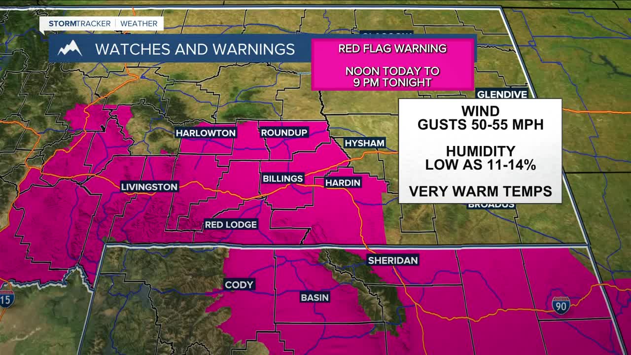
Wednesday will also be quite dry, with low humidity. This, combined with the warmer temperatures and strong winds, will bring a critical grass fire danger. Red Flag Warnings will also be in effect Wednesday for much of south-central MT and northern WY during the afternoon and evening hours. Don't cause a spark! Winds will ease by the evening as a cold front sweeps through.
An upper-level wave will help steer that cold front down through the region, bringing a chance of mountain snow and lower elevation rain Wednesday afternoon into the evening, followed by another wave keeping a chance of more precipitation in the forecast on Thursday.
In terms of accumulation, a couple inches of snow will be possible in the mountains above 6,000 feet, while the foothills could receive a few tenths of an inch. The lower elevations can expect mainly light rain ranging from less than a tenth to around a quarter of an inch, but some wet snow could mix in, especially across the higher hills where minimal accumulations could occur.
Daytime temperatures will be cooler and near seasonal on Thursday behind the front, with highs in the mid-40s to low 50s, but this will be short-lived as high pressure will bring warmer temperatures and dry conditions on Friday, the weekend, and into early next week, with highs in the 50s on Friday, 60s and 70s on Saturday and Sunday, then mid-70s on Monday. Some models are hinting at a cooldown by the middle of next week.
Miller Robson
Q2 Morning Meteorologist
miller.robson@ktvq.com
