


BILLINGS — A warm front will bring a chance of rain across the region Tuesday morning, with a wintry mix or even freezing rain possible in the east. Only minor impacts are expected, but still watch out for slick roads in these areas. Periods of light snowfall in the mountains through Tuesday night.
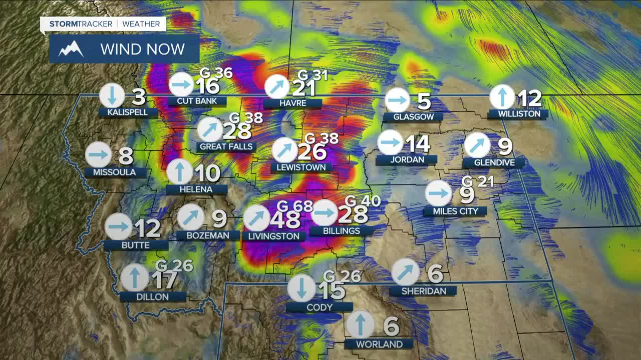
Prepare for strong winds on Tuesday, with gusts between 55–70 mph (maybe stronger) expected across the western foothills, gusts up to 60 mph north of Yellowstone County, while the rest of the area could feel gusts between 30–50 mph. Snow remaining on the ground may limit the winds a bit due to an inversion with warmer air aloft, though. Periods of strong winds of over 50 mph will continue across the western foothills through Saturday.
With the strong winds, lower humidity, and warmer temperatures, there will be an elevated fire danger in parts of northern Wyoming, so don't do anything outdoors that will cause a spark.
A warmer and drier trend really begins to kick in as high pressure moves in. Daytime highs will reach into the 50s and 60s on Tuesday, before increasing into the 60s and 70s on Wednesday. Expect mainly 70s on Thursday and Friday, with record highs possible. Some locations could crack 80 degrees on Friday, including Billings.
Some models show high pressure easing up over the weekend, so a cooler and wetter pattern may move in, but there is still a good bit of uncertainty on this at the moment.
Miller Robson
Q2 Morning Meteorologist
miller.robson@ktvq.com
