


BILLINGS — Friday will be beautiful with abundant sunshine and warmer daytime highs, generally in the mid to upper 80s. Wind gusts between 20-40 mph out of the southwest will be possible across the western foothills.
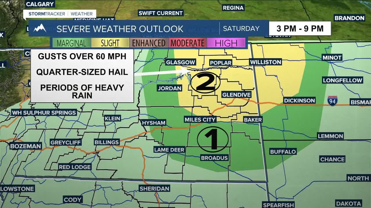
More strong to severe thunderstorms are possible across eastern Montana on Saturday as a strong weather system approaches from the west. Southeast winds will continue to pump moisture into the region, while warmer-than-average temperatures (highs in the upper 80s to low 90s) and increasing instability will help provide the fuel for storms to develop by Saturday afternoon and into the evening. The main threats will be quarter-sized hail, gusts over 60 mph, and periods of heavy rain. A chance for scattered showers and thunderstorms continues into Sunday, with strong to severe storms still possible in eastern MT. Keep an eye on the forecast if you have outdoor plans.
Monday will be quiet with a healthy dose of sunshine before an unsettled weather pattern returns Tuesday, bringing chances of daily showers and thunderstorms through the rest of the week.
Daytime highs will briefly cool into the upper 60s to mid-70s on Sunday behind a cold front, then warm into the upper 70s to low 80s on Monday and low to mid-80s on Tuesday. There is potential for another system to move through midweek and cool temperatures down into the upper 70s to low 80s on Wednesday, then mid-70s on Thursday.
Miller Robson
Q2 Morning Meteorologist
miller.robson@ktvq.com
