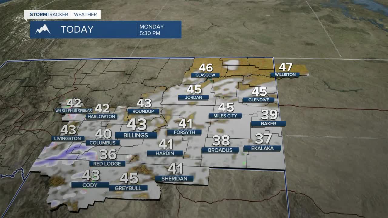


BILLINGS — Some locations will be waking up to snow and temperatures will be in the mid-20s to near 30 degrees across the region on Monday morning, so expect roads to be slick and slushy. Some areas could also be dealing with reduced visibility. Be prepared for a difficult morning commute. A few inches of snow could accumulate in the lower elevations (greatest in the highest hills) and several inches across the mountains before the system moves out Monday night. Much of the region could get a quarter of an inch of moisture off this system. The cool and wet weather will be hazardous for young livestock. Daytime highs will be in the low to mid-40s.
The region will be under the influence of robust flow out of the northwest through the middle of the week, so rain showers will be possible mainly west and south of Yellowstone County Tuesday afternoon through Wednesday. Although highs will be warming into the 50s and 60s, some graupel or small hail could be possible in any heavy rain showers that develop. There could also be just enough instability for a few rumbles of thunder by Wednesday. The mountains will have a good chance to pick up a few inches of snow Tuesday and Wednesday.
High pressure is expected to bring mainly dry conditions, along with warmer temperatures, into the region for the second half of the week. Daytime highs will be in the 60s and 70s Friday and Saturday.
Some models are showing low pressure steering a cold front through the region by Sunday, bringing a chance of cooler temperatures and precipitation to wrap up the weekend.
Miller Robson
Q2 Morning Meteorologist
miller.robson@ktvq.com
