


BILLINGS — Westerly downslope winds will help warm things up on Tuesday as conditions stay mainly dry, with highs pushing back into the mid to upper 60s.
Wednesday will start off mainly dry ahead of an upper-level low and cold front that will begin to impact the region by Wednesday afternoon. Ahead of this system, downslope winds will increase along the western foothills, with gusts between 40–50 mph, while much of the rest of the area could see gusts between 20–35 mph by the afternoon. These winds will help push daytime temperatures to near 70 degrees in our central and eastern zones, but increasing cloud cover will hold western areas down in the low to mid 60s.
The chance for showers will increase during the afternoon across the western mountains and foothills. The warmer temperatures could even produce an isolated afternoon thunderstorm or two.
The low will move southeast Wednesday night into Thursday. The latest model runs are beginning to show a good chance that the system will split as it gets closer. How will this impact the area?
Scenario #1: Some models have the bulk of the energy moving to the north of our area. If this pans out, it would significantly lower precipitation amounts Thursday and Friday.
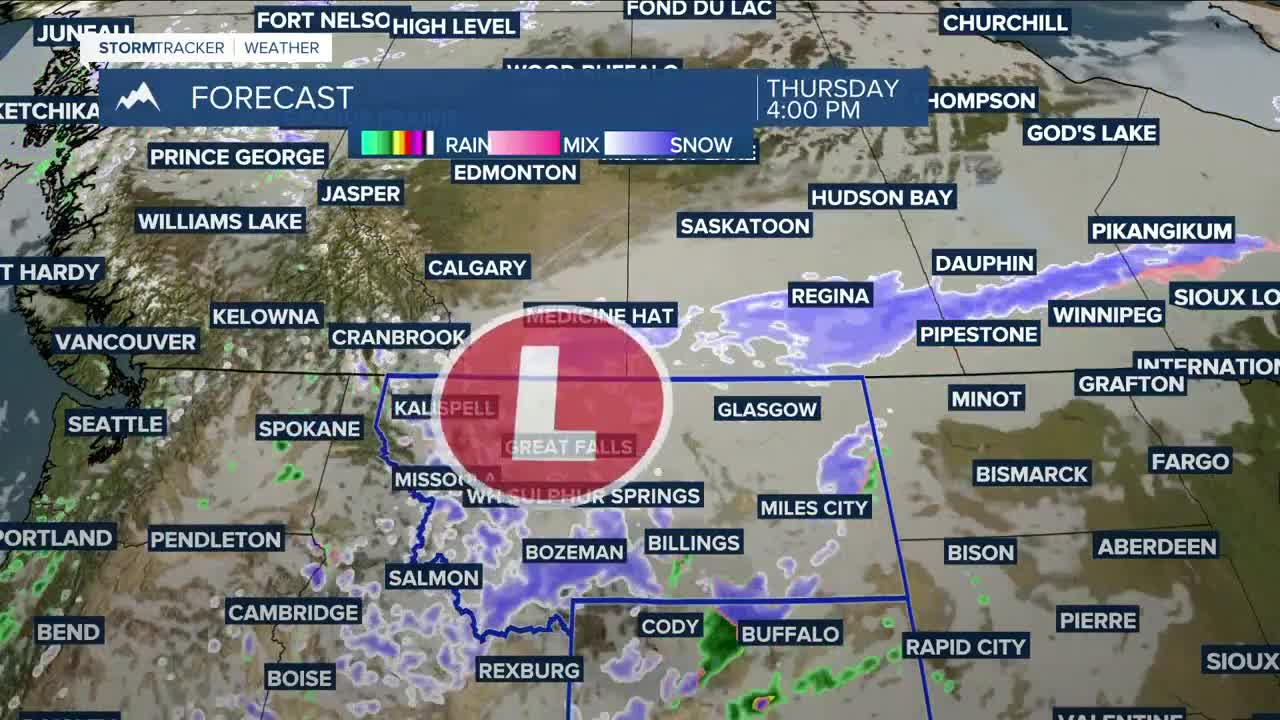
Scenario #2: Other models have most of the energy taking a southern track, which would push a healthy amount of moisture over the western half of the area. It will be interesting to see which model wins out. This would mean more than a foot of snow could accumulate in the Beartooths, Absarokas, and Crazies, with over an inch of moisture possible. A Winter Storm Watche will be in effect for the Beartooths and Absarokas.
Snow levels are still forecast to drop from around 7,000 feet Wednesday afternoon to around 3,500 feet by Thursday afternoon. This would bring a decent chance of snow in the lower elevations late Thursday afternoon through Friday. If Scenario #2 wins out, a few inches could potentially accumulate, with the best chance west and south of Billings. Moisture totals could reach a quarter inch or more over western and central areas, but to a lesser extent from Rosebud County and areas east. Keep an eye on the forecast if you’ve got outdoor or travel plans Thursday and Friday, as this system is still evolving.
Friday aims to be cool and unsettled. Depending on how that upper low evolves, some lingering showers will be possible. Highs will be mainly in the 40s, with a few spots dipping into the upper 30s.
High pressure is forecast to bring warmer and drier conditions across the weekend, with highs mainly in the 50s on Saturday, then 60s to near 70 degrees on Sunday.
Miller Robson
Q2 Morning Meteorologist
miller.robson@ktvq.com
