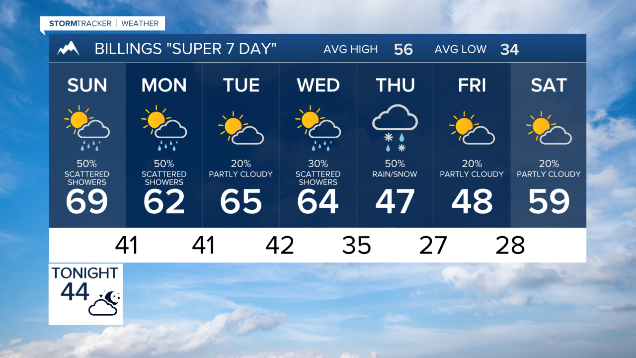


BILLINGS — A slow-moving trough will slide into the Northern Rockies through early next week, keeping things a bit unsettled. Temperatures cool slightly on Sunday, but will still be above normal, with highs in the 60s to low 70s.
We’ll have another round of afternoon showers and a few thunderstorms Sunday. Winds at the surface turn easterly to northeasterly, pulling in some Gulf moisture. There could still be enough instability in Billings and areas west and south that a few weak thunderstorms could fire up, with the main concern being gusty, erratic winds.
Monday into Tuesday brings a better chance for scattered showers and maybe a weak thunderstorm or two, but models continue trending drier overall. Lower elevations could receive up to at least a quarter inch of rainfall, while the mountains could get 1–4 inches of snow to around 8,000 feet. Locally higher amounts are possible on southwest-facing peaks.
We may catch a bit of a break midweek before the next round moves in late Wednesday into Friday. Timing is still a little uncertain, but confidence is growing that cooler air settles in by the end of the week.
Highs trend down into the 50s and 60s by Tuesday and Wednesday, 40s to 50s Thursday, and even 30s to mid-40s by Friday.
Miller Robson
Q2 Morning Meteorologist
miller.robson@ktvq.com
