


BILLINGS — The broad upper low that has impacted the area over the last several days will continue to slowly move to the northeast of the region on Wednesday, but there is still a chance for wrap-around moisture to produce a few showers or even a weak isolated thunderstorm or two throughout the day, mainly north and northeast of Yellowstone County, before the low fully exits. The rest of the region will be under the influence of northwesterly flow, so expect mostly quiet conditions. Daytime highs will be mainly in the low to mid-70s.
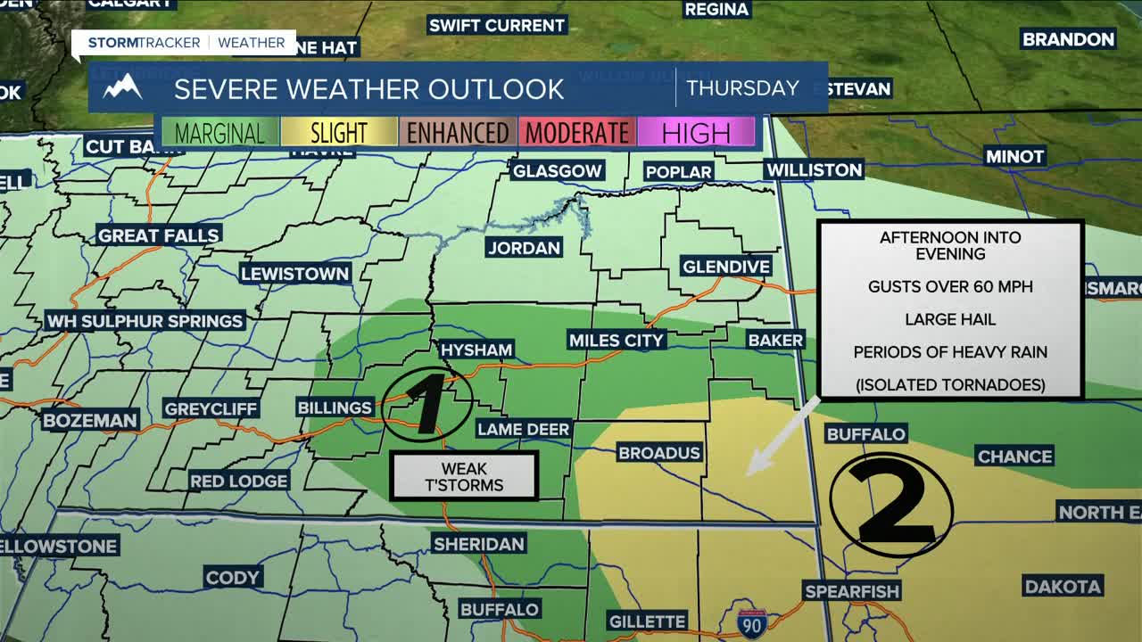
Converging winds, along with incoming low-level moisture, will bring the chance for potentially strong to severe storms Thursday afternoon and evening from Billings to eastern MT and over into the Dakotas. As of now, there is a SLIGHT RISK (2 of 5) for strong, gusty winds, large hail, and periods of heavy rainfall in southeast MT. Isolated tornadoes cannot be ruled out as well. Daytime highs will be mainly in the mid to upper 70s.
High-pressure ridging will bring dry conditions on Friday and most of Saturday as daytime highs warm into the low to mid 80s on Friday, then upper 80s to low 90s on Saturday.
Models are forecasting a strong Pacific storm system to begin impacting the region by late Saturday into Sunday, bringing chances for showers and thunderstorms. Furthermore, a cold front is also forecast to move through Saturday night into Sunday, which will not only cool temperatures down mainly into the 70s on Sunday, it will also help add to the potential for some strong thunderstorm activity that day. Too early to say with absolute certainty at the moment, but be sure to keep informed of the latest forecasts in case you have outdoors plans.
Daytime highs will warm back into the upper 70s to low 80s on Monday, then upper 80s to low 90s on Tuesday.
Miller Robson
Q2 Morning Meteorologist
miller.robson@ktvq.com
