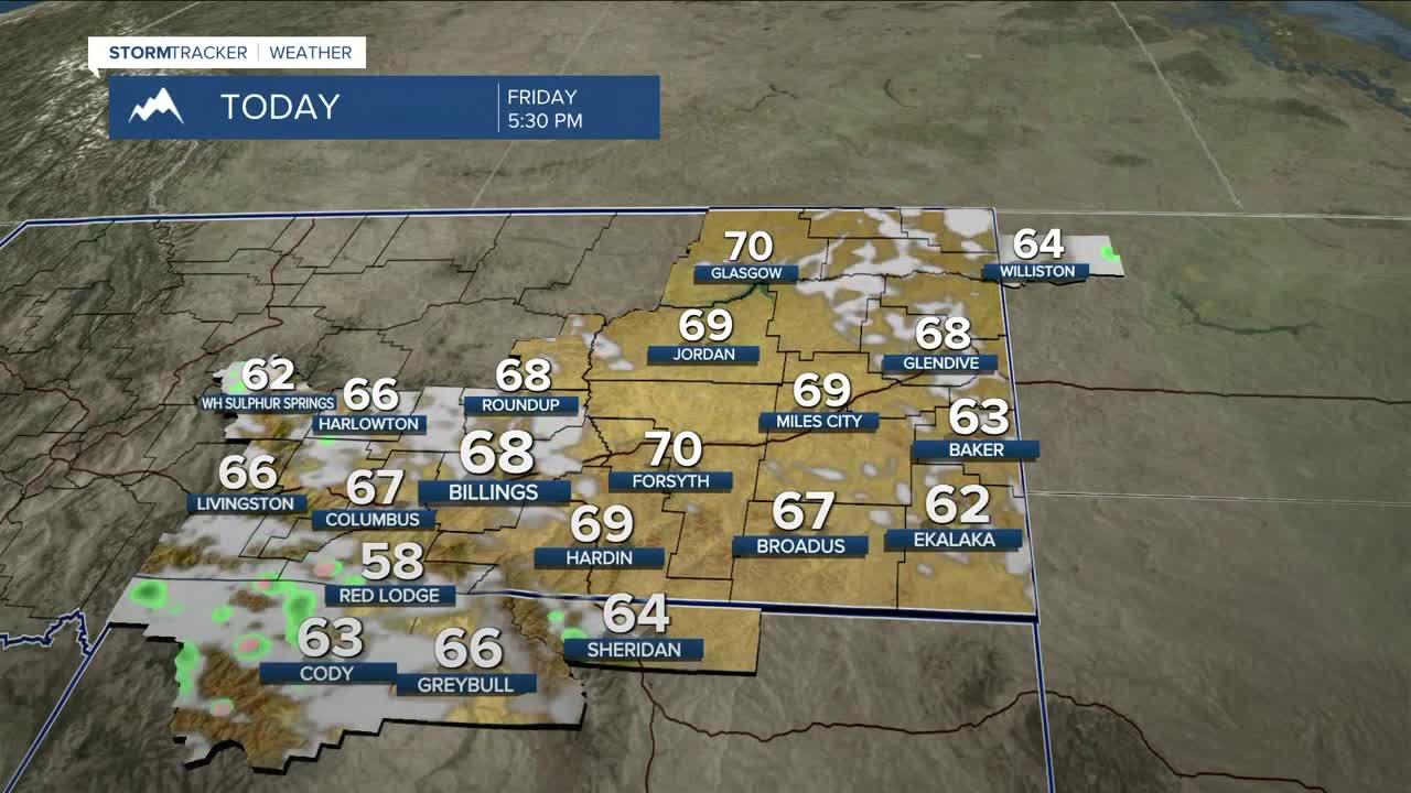


BILLINGS — The trough that brought rain and mountain snow over the last two days has moved east, and high pressure is bringing dry conditions back into the region, although some lingering rain is possible in eastern MT through early Friday afternoon. A weak disturbance could bring a few isolated showers during the afternoon into the evening, mainly across our western zones. Warmer air moves in, pushing daytime highs into the 60s.
The warming trend continues through Memorial Day weekend and into early next week as high pressure builds. Daytime highs will be in the 70s Saturday, then 80s Sunday and Monday. Some locations could reach the 90s on Monday, including Billings, which could see a record high. Most areas should stay dry, but daily isolated showers could pop up, especially near the mountains. It will also be windy at times, with gusts between 15-30 mph possible across the western foothills on Sunday.
The warmer temperatures will ramp up snowmelt, so expect increases flow in rivers and risings stream and creeks.
An upper trough is set to move into the Pacific Northwest on Memorial Day and could bring some precipitation to our western zones by the evening. Models are still in disagreement on how the system will evolve, but there is indication that there will be some increase in rain and thunderstorm chances Tuesday through the middle of next week, along with a cooldown. Temperatures do look to stay above average.
Miller Robson
Q2 Morning Meteorologist
miller.robson@ktvq.com
