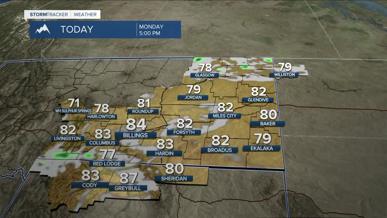


BILLINGS — A mostly dry cold front moving across the region on Monday will come in two waves- the front moves through during morning, followed by a big surge of wind in the afternoon as high pressure builds in behind it. Expect breezy north winds with both rounds, with widespread gusts of 20 to 45 mph. This, combined with warmer temperatures (highs in the upper 70s to mid-80s) and low humidity, will bring critical fire danger. A Red Flag Warning will be in effect from 9 AM to 9 PM for parts of Treasure, Rosebud, Custer, Fallon, and Carter Counties, especially along and north of I-94 and Highway 12. A few isolated showers and weak thunderstorms could pop up late Monday afternoon into the evening, mainly near the Wyoming over to the Dakota border, especially around the mountains and foothills.
Very warm and dry weather continues Tuesday into Wednesday as high pressure digs in. Highs Tuesday stay mainly in the 70s before climbing into the 80s and even low 90s by Wednesday. Some locations like Billings, Livingston, and Red Lodge could come close to record highs. South winds could also become breezy Wednesday, with gusts between 15 and 35 mph.
By late Wednesday into Thursday, forecast models are lining up better on a trough moving through the region, bringing a better chance for showers and thunderstorms. Rain chances increase to 20–60% Thursday afternoon, with additional chances each day through the weekend. Winds will be increase again on Thursday with gusts over 40 mph across much of the area.
Temperatures will trend cooler as well, dropping from the 70s and low 80s Thursday to mainly the 60s by Sunday.
The warmer temperatures will bring accelerated mountain snowmelt this week, so expect rising stream and river levels. No flooding is expected, but watch out for stronger flows and currents.
Miller Robson
Q2 Morning Meteorologist
miller.robson@ktvq.com
