


BILLINGS — Winds will be breezy to windy, with gusts between 25 and 45 mph (strong across foothill areas) on Monday ahead of a cold front, especially across foothill areas. With warm temperatures, low humidity, and gusty winds, a Red Flag Warning is in effect for parts of northern WY, including Cody. There is also an elevated grass fire concern for Sheridan County, WY. Avoid outside burning and anything that could cause a spark. Daytime highs will range from the upper 50s to mid-60s, but parts of northern WY could reach the low 70s.
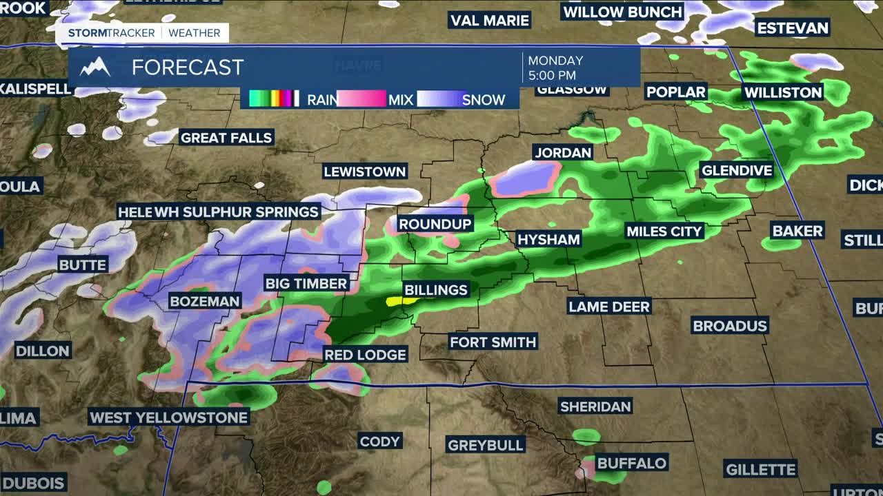
The cold front will pass through Monday evening, bringing a chance of several inches of snow in the mountains, a few inches or more in the foothills (Winter Weather Warning in the Red Lodge foothills), and light rain or wet snow in the lower elevations. Some locations in central and southern MT, including Billings, could receive over a quarter of an inch of total moisture. Watch out for icy roads Monday night into Tuesday morning.
High pressure will bring mainly dry conditions Tuesday and Wednesday, although snow will remain possible in the mountains and foothills. It will be cooler, with highs mainly in the 40s on Tuesday, then 40s and 50s on Wednesday.
We are keeping an eye on another system moving in Thursday and Friday, but models are still uncertain about its impacts. If the trough proves to be on the stronger side, there is potential for a beneficial amount of precipitation. However, there is still considerable uncertainty at this point. Stay tuned!
Miller Robson
Q2 Morning Meteorologist
miller.robson@ktvq.com
