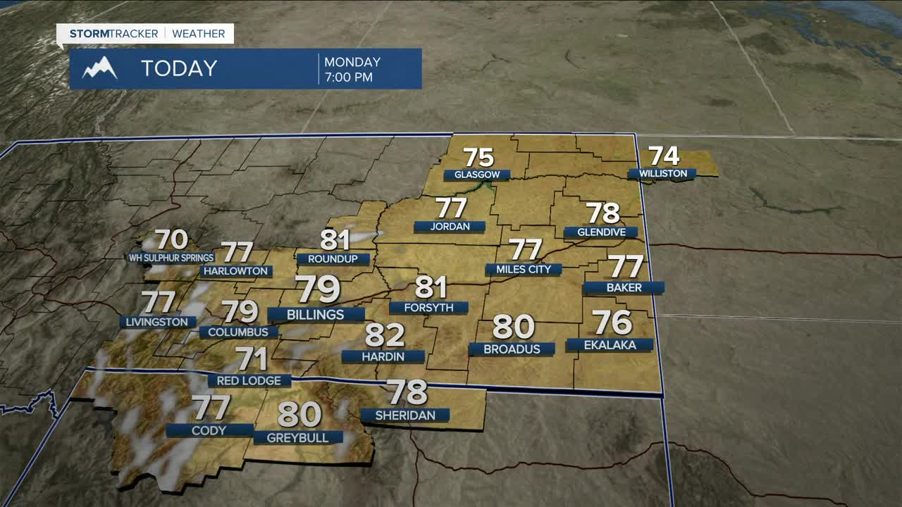


BILLINGS — Expect warm, sunny, and dry conditions over the next few days as high pressure builds in. Daytime highs will be in the mid-70s to around 80 degrees on Monday, then mainly mid-80s on Tuesday, with a few locations approaching 90 degrees.
This will be a dry heat, and mountain snowmelt will be faster, so expect some rises in rivers and streams, but no flooding is expected. Warm temperatures and low humidity will also bring a concern for fire weather, but winds should stay mainly light through Tuesday. Wednesday, however, could see stronger gusts between 20–45 mph, especially west of Billings and into north-central Wyoming, so the fire weather concern will be bigger. The good news is spring green-up should help keep impacts in check. Still, use caution if you plan to do any outside burning.
Late Wednesday into Friday, a complex spring system moves in, bringing the return of strong winds, rain/snow, and much cooler temps. The big question is the exact track of the low Thursday and how it evolves into Friday and Saturday, which will determine wind strength and how widespread and long-lasting the precipitation and cool-down end up being.
Winds pick up late Wednesday into Thursday, the strongest Thursday as the pressure gradient tightens, bringing a chance for 60+ mph gusts, highest across eastern Montana into northern Wyoming. A few showers and isolated storms may develop Wednesday ahead of a cold front, with rain chances ramping up late Wednesday into Thursday, but models have begun to trend drier as cooler, drier air is forecast to move in quicker. Still, there’s a decent chance of around three quarters of an inch of total moisture, with the highest in the mountains and foothills south of Billings. Rain may transition to snow in the lower elevations, with a slight chance of more than 2 inches in the foothills. Mountains will see all snow, with between 6-12 inches possible.
Potential travel issues could arise with slick roads and reduced visibility due to blowing snow, along with dangerous conditions for young livestock due to the cool, wet, and windy setup. Again, this is a complex system, and small track shifts will make a big difference, so keep checking back for the latest updates through the week.
This system will bring a cooldown, with highs in the 40s Thursday through Saturday, with a few locations warming back into the low 50s on Sunday.
Miller Robson
Q2 Morning Meteorologist
miller.robson@ktvq.com
