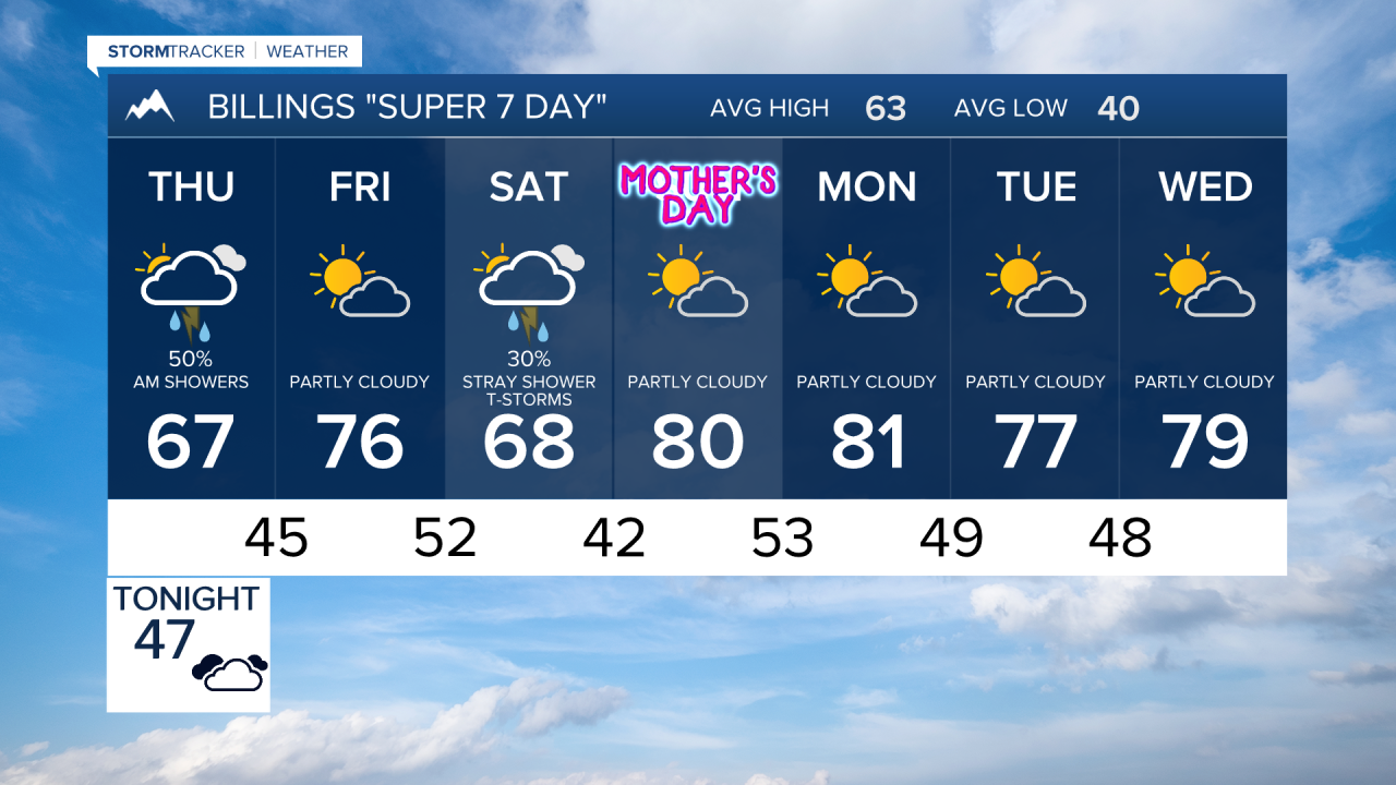

BILLINGS — THROUGH THURSDAY MORNING: An approaching shortwave will bring our first round of precipitation. Expect breezy winds to pick up ahead of the system, with gusts reaching 15 to 30 mph, strongest around and west of Billings. These winds will ease slightly Thursday morning before ramping up again in the afternoon.
THURSDAY: The main event arrives with scattered showers and thunderstorms making their dramatic entrance. Warm temperatures in the 60s to low 70s will fuel the action, with moisture levels running 100 to 150% above normal. The mountains and areas as far east as Billings face the highest chances for precipitation.
Stronger showers and any thunderstorms will pack a punch with brief moderate to heavy rainfall and gusty winds. The weather assault gradually winds down from the northwest to southeast late Thursday night.
FRIDAY: Brief ridging rebuilds, offering a welcome respite. High temperatures climb into the 70s with little to no chance of precipitation.
LATE FRIDAY THROUGH SATURDAY: Another shortwave trough moves through the Northern Rockies, bringing a second round of showers and weak thunderstorms. Southeast Montana faces low to moderate chances for at least a tenth of an inch of rain. While strong storms aren't anticipated, a few rumbles of thunder remain possible. Breezy to gusty winds return with authority, gusting between 20 to 45 mph as pressure rises across the area.
SATURDAY NIGHT THROUGH EARLY NEXT WEEK: A backdoor cold front slides in Saturday night, though impacts remain minimal. Overnight lows will settle into the 30s to low 40s. Sunday marks the beginning of a more stable pattern as ridging and northwest flow aloft return, ushering in above-normal temperatures in the 70s and 80s along with drier conditions through the first half of next week.
