

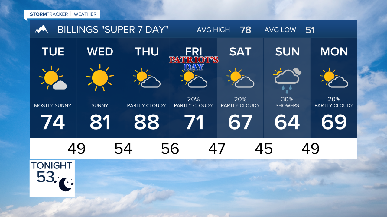

BILLINGS — A windy stretch this week will keep fire weather concerns elevated, but after a warm and dry midweek period, a cooler and potentially wetter pattern looks poised to return by the weekend.
TUESDAY
West to northwest winds will frequently gust between 20 and 45 mph, with the strongest winds over eastern Montana. Most locations will stay dry, but a few isolated showers may develop, especially near the mountains and foothills. Any shower activity could produce locally stronger wind gusts even if little rain reaches the ground. High temperatures will remain cooler than recent days, generally topping out in the 70s. Elevated fire weather concerns continue due to the combination of dry fuels and gusty winds.
WEDNESDAY
Billings and surrounding communities should see highs climb back into the lower 80s under mostly dry conditions. Winds will be lighter than earlier in the week with occasional afternoon breezes. Fire weather concerns will remain as the humidity drops during the warmest part of the day.
THURSDAY
Afternoon temperatures should reach the 80s, making this the warmest day of the week. Sunshine with increasing southwest breezes may develop during the afternoon. Localized elevated fire weather concerns are expected, particularly in open grassland areas.
FRIDAY
Temperatures will start trending cooler, and clouds will increase through the day. The chance for showers will gradually increase, especially later in the day and into the evening. Forecast confidence decreases somewhat by this point, but signs point toward a more unsettled pattern developing.
SATURDAY
Scattered showers are possible throughout the day, with cloud cover helping keep temperatures cooler. Outdoor plans may be interrupted periods of rain, though the exact coverage and timing remain uncertain. Mountain locations could become cold enough to see the season's first snowfall of the higher peaks by Saturday night through Sunday morning.
SUNDAY
Cooler-than-normal conditions are expected to continue with at least a chance for additional showers across south-central and southeast Montana and northern Wyoming. The overall trend favors a more autumn-like weather pattern with lower temperatures and periodic precipitation opportunities for next week.
Anyone with travel or recreation plans in the mountains should keep a close eye on forecast updates later this week.
