

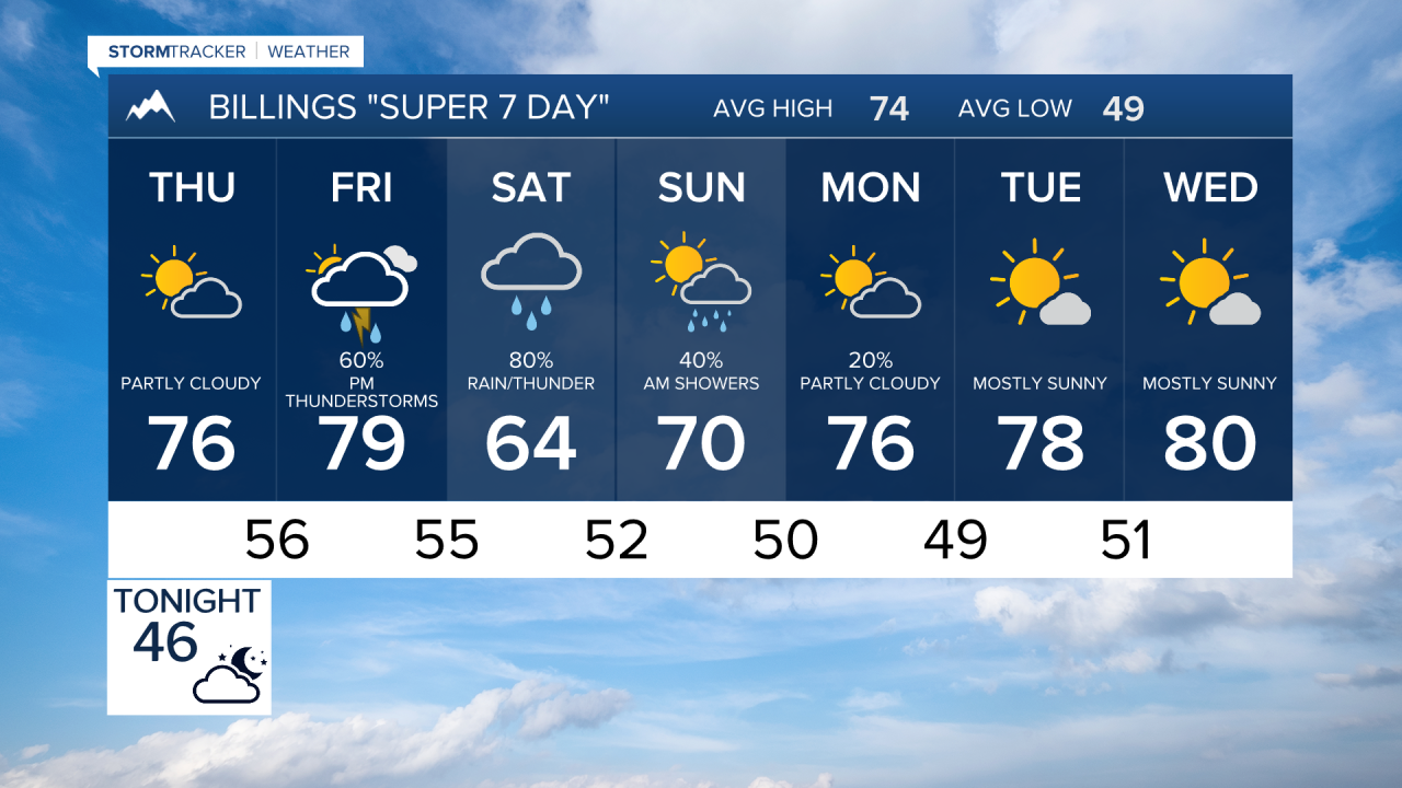

BILLINGS — A stretch of quiet weather continues through Thursday morning before a significant pattern change arrives. Increasing moisture will lead to thunderstorms late Thursday, followed by a wet weekend with widespread rain, some heavy rainfall potential, and a few strong thunderstorms Friday.
TONIGHT
Mostly clear and cool across the region with light winds. Areas east of Billings could see patchy valley fog develop overnight. Lows generally in the 40s.
THURSDAY
Increasing clouds and moisture by afternoon. Isolated to scattered showers and thunderstorms will develop, especially across southern Montana and northern Wyoming. Southeast Montana has the greatest chance of heavier downpours by evening. Highs reach the upper 70s to lower 80s.
THURSDAY NIGHT
Showers and a few thunderstorms continue, particularly across southeast Montana. Moisture levels increase significantly, setting the stage for a wetter period ahead. Some locally heavy rainfall will be possible.
FRIDAY
Weather becomes more active. Scattered thunderstorms develop during the afternoon and evening, with the best chance for stronger storms from Billings eastward into southeast Montana. A few storms could produce strong winds, hail, and very heavy rainfall. Highs stay in the upper 70s to lower 80s before cooler air arrives later in the day.
FRIDAY NIGHT
Rain and thunderstorms become more widespread across the region. Heavy rainfall will be possible in some locations as atmospheric moisture climbs to unusually high levels for September.
SATURDAY
Widespread rain, embedded thunderstorms, and periods of moderate to heavy precipitation are expected across south central and southeast Montana and northern Wyoming. Outdoor plans will likely be impacted. Rainfall amounts could become significant, and localized flooding concerns may develop where heavier bands persist. Highs cool into the 60s.
SATURDAY NIGHT
Continued widespread rain with areas of heavy precipitation. Snow will be limited to the highest Beartooth and Absaroka peaks.
SUNDAY
Rain gradually tapers from west to east. Billings to the west may begin drying out during the afternoon, while southeast Montana could continue to see showers into the evening. Temperatures remain cool, with highs mainly in the 70s.
MONDAY
Lingering showers possible early, mainly across far eastern Montana, otherwise improving conditions with decreasing clouds and drier weather spreading across the region. Temperatures recover into the mid and upper 70s.
TUESDAY AND WEDNESDAY
Dry weather returns with seasonable temperatures and mainly sunny skies. Afternoon highs remain in the upper 70s with cool overnight lows in the 40s and lower 50s.
