

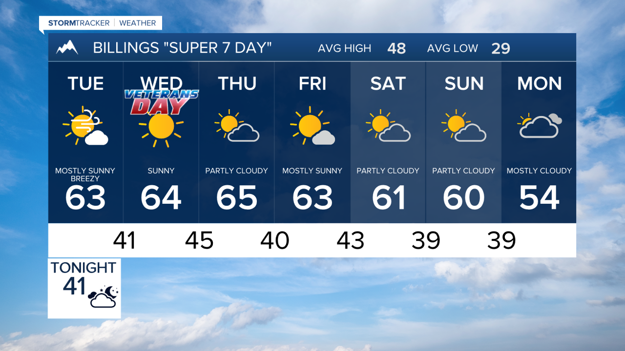

BILLINGS — A fast-moving disturbance brings breezy to windy conditions and a small chance of showers Tuesday, followed by a return to unusually warm and mostly dry weather. Temperatures climb well above normal by Thursday before signs of turning cooler and potentially more unsettled late in the weekend or early next week.
TUESDAY
A weak weather system moves through the region, bringing increasing west to northwest winds along with a 20 percent chance of light showers. The strongest winds are expected around the western foothills, including Livingston, Big Timber and Harlowton. A few locations could briefly gust into the lower 40s. Gusts of 25 to 35 mph will be common across the plains. Highs will generally reach the 50s to lower 60s.
WEDNESDAY
Upper-level high pressure quickly rebuilds, bringing dry and warmer weather. Highs return to the lower and middle 60s across much of southern Montana and northern Wyoming.
THURSDAY
The warming trend peaks as strong high pressure remains in control. Afternoon temperatures rise into the 60s to near 70 degrees, roughly 15 to 25 degrees above normal for mid-November. Sheridan could reach around 70, while Billings is forecast near the mid-60s. Dry weather continues.
FRIDAY
Warm and mainly dry conditions continue to close out the workweek. Highs remain solidly in the 60s across much of the area, keeping temperatures well above seasonal averages.
SATURDAY
The ridge gradually begins to weaken, but the region remains mostly dry and mild. Highs generally stay around the upper 50s to middle 60s across the plains and lower elevations.
SUNDAY
Changes begin taking shape as lower atmospheric heights spread inland across the western United States. Most of the region should remain dry, although a slight chance of precipitation starts returning around the western mountains and foothills. Temperatures remain mild, generally upper 50s to lower 60s.
MONDAY
Confidence increases in a gradual pattern change as the ridge breaks down further. Temperatures trend cooler, with highs generally in the 50s, while precipitation chances begin increasing somewhat around the western mountains and foothills. This could mark the beginning of a cooler and more unsettled period heading into next week.
