

BILLINGS — TODAY THROUGH THIS EVENING: Scattered showers and thunderstorms will increase in coverage late this afternoon as a vigorous cold front pushes from west to east. Thunderstorms pack erratic wind gusts of 25-35 mph, brief downpours, and the possibility of pea-sized hail due to relatively low freezing levels.
The storms won't be severe, but they'll certainly make their presence known with sudden wind gusts and localized moderate rainfall. Anyone with outdoor evening plans should keep a close eye on the sky and be prepared to head indoors quickly.
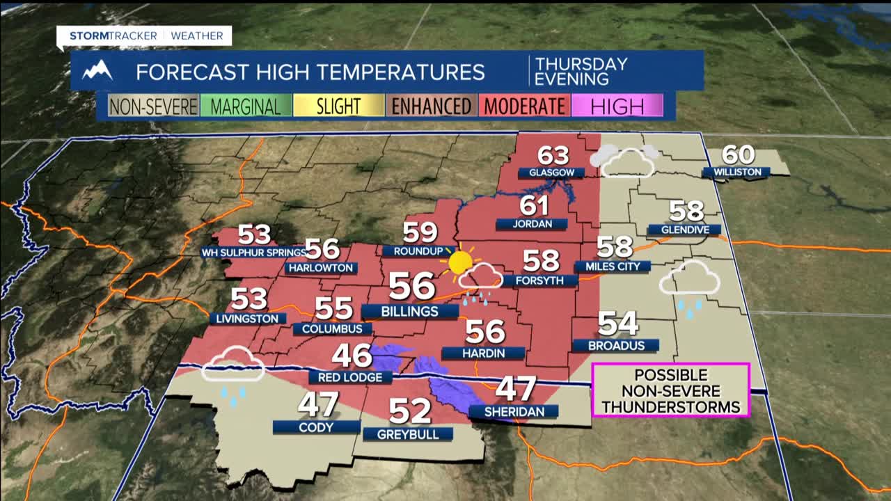
TONIGHT THROUGH THURSDAY: Expect widespread, steady precipitation. A cooler air mass creates a very good setup for substantial rain and snow around the mountains and foothills with better than a 75% chance of seeing over half an inch of precipitation, with some spots potentially reaching over an inch.
Even Billings and Hardin have a 50% chance of collecting half an inch of rain. Meanwhile, snow levels drop from over 8,000 feet today down to around 6,000 feet by Thursday morning, setting up significant snowfall on north-facing slopes of the high country.
The Beartooths will benefit the most with 8-13 inches of snow expected, while the Big Horns could see 5-10 inches through Thursday evening. This heavy mountain snow may impact Friday's scheduled opening of the Beartooth Highway, requiring plowing operations before the road becomes passable.
Red Lodge might wake up to wet snow Thursday morning with about an inch accumulating on natural surfaces, though roads should remain just wet or slightly slushy. Cooke City could pick up 3-5 inches of accumulation.
FRIDAY THROUGH EARLY NEXT WEEK: WARMING RECOVERY
Friday marks the beginning of a significant warming trend that will dominate the weather pattern through early next week. After Thursday's chilly temperatures in the 40s and 50s, expect a steady climb back to the 60s Friday, 70s Saturday, and into the 80s by Sunday. Monday, Billings could challenge the daily record high off 88 degrees for May 25.
The weather will be mostly dry during this period, though weak atmospheric disturbances may trigger isolated afternoon thunderstorms mainly over the mountains.
