

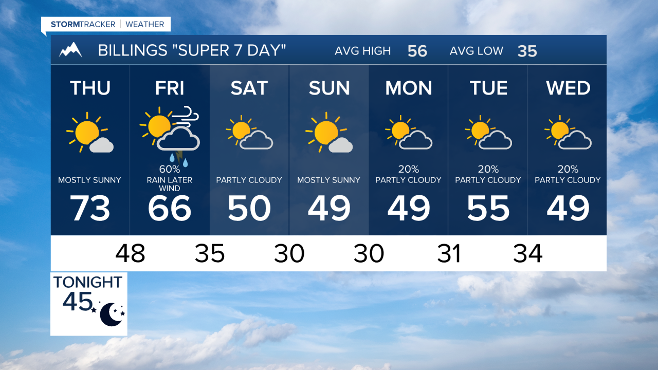

BILINGS — A noticeable change arrives late Thursday night into Friday with rain, mountain snow and increasing winds, followed by a much cooler weekend.
THURSDAY: Another warm and largely dry day is expected, with widespread 70s and temperatures approaching 80 degrees in parts of southeast Montana. Clouds will begin increasing as the next storm system approaches from the west.
FRIDAY: Big changes arrive as a storm system moves into the region. Rain becomes increasingly likely, especially around and west of Billings, with the higher mountains changing over to snow. Snow levels should generally remain above 6,000 feet. Livingston and the Paradise Valley could also turn quite windy early Friday as the system approaches. Farther east and toward northern Wyoming, precipitation chances will be somewhat lower and highs stay warm ahead of the front.
SATURDAY: Much colder weather settles in behind the system. Highs fall mainly into the upper 40s and lower 50s, a drop of roughly 20 to 30 degrees from Thursday in many locations. Rain and mountain snow decrease, while breezy to windy conditions remain possible across the region.
SUNDAY: Mostly dry and seasonably cool weather returns, with highs generally around 50 to the lower 50s and overnight lows dipping into the 20s and lower 30s.
MONDAY: A few weak disturbances trailing behind the weekend system could produce scattered light rain or snow showers. Temperatures remain near to slightly below late-October averages, with highs mostly in the upper 40s to lower 50s.
TUESDAY: Temperatures show signs of rebounding somewhat, with many locations returning to the mid and upper 50s. The overall weather pattern remains active, but forecast confidence drops considerably by this point as the longer-range models disagree on how the next systems will evolve.
