



BILLINGS — THROUGH TONIGHT: Showers continue to soak much of the area. From the west, downslope winds create breaks in the precipitation. Through tonight, expect an additional rainfall especially east of Billings.
The Beartooth Highway above Vista Point face snow showers that could create slippery travel conditions. A Winter Weather Advisory remains in effect for this area, though snow accumulations will be minimal.
Non-severe thunderstorms may rumble across eastern Montana counties and near the southern mountains this evening, but nothing dangerous is expected. As the precipitation shifts northward tonight, downslope winds should help prevent fog formation despite the recent heavy rainfall – some areas have picked up over 2 inches.
MONDAY: Another wave approaches from Oregon. This trailing system teams up with daytime heating to trigger scattered afternoon and evening showers and thunderstorms. Temperatures climb into the low-to-mid 70s.
Most of Monday's storm activity will remain non-severe, but southeastern Montana may see a couple of stronger cells.
TUESDAY THROUGH WEDNESDAY: An upper-level low pressure system parks itself over southern Saskatchewan. This pattern maintains at least a 20-30% chance of showers and thunderstorms each day as temperatures continue their gradual climb – expect highs in the low-to-mid 70s Tuesday, reaching the mid-70s by Wednesday.
Tuesday brings a brief risk of severe storms in the far eastern Montana counties, but the main severe weather threat appears to stay in the Dakotas. Wednesday looks like the more tranquil day as the atmosphere becomes more stable.
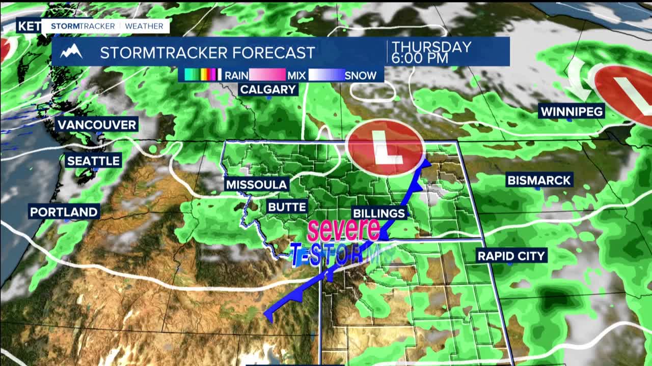
THURSDAY: This could be the day to watch as a Pacific wave brings severe thunderstorm potential, including damaging hail. Temperatures warm into the 75-80 degree range and winds shift to the east-southeast.
FRIDAY THROUGH THE WEEKEND: Friday offers mostly dry conditions and warmer temperatures reaching the upper 70s to mid-80s. followed by possible 90 degrees by Saturday.
The weekend brings increasing thunderstorm potential as energy emerges from the Pacific trough. This setup could deliver another round of severe weather possibilities, marking our entrance into the more active thunderstorm season
