

BILLINGS — WEDNESDAY NIGHT: Winds ease somewhat by evening as upper-level flow backs off and atmospheric mixing winds down for the day.
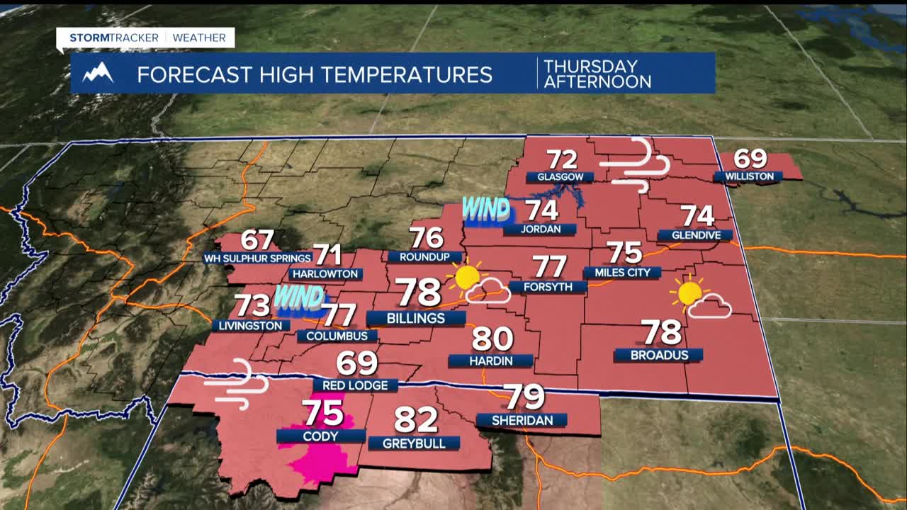
THURSDAY THROUGH SATURDAY: A powerful upper-level ridge shoves its way across the western US, sending temperatures soaring 25 to 30 degrees above average. High temperatures climb into the 70s and low 80s Thursday and Friday and could break daily records. Breezy conditions continue, with wind gusts in the 30s to occasional 40s mph each day across the lower elevations.
That combination of warmth, wind, and dry air creates elevated wildland grassfire conditions through Saturday, particularly across areas that missed out on meaningful moisture with the last storm system. If you're in fire-prone areas, treat this stretch with serious caution.
SATURDAY NIGHT INTO SUNDAY: A cold front is on track to sweep through sometime over the weekend, but the exact timing is unknown right now. An earlier arrival means cooler temperatures dropping back into the 60s with a 30 to 60% chance of precipitation on Saturday. A later passage keeps the near record-warm pattern rolling with continued fire concerns before the front finally arrives.
Either way, precipitation amounts look light, with only a 20–40% chance of picking up more than a tenth of an inch. In any case, temperatures will be somewhat cooler on Sunday, mainly in the 50s. An average high this time of the year would be about 50.
MONDAY AND BEYOND: Above-average temperatures are expected to rebuild quickly by Monday. There are some mixed signals for later in the week, but another cooler and wetter pattern is possible.
