

BILLINGS — TODAY THROUGH TUESDAY: A ridge of high pressure is settling in, bringing increasingly warm conditions across south-central Montana and north-central Wyoming. The heat builds Monday with temperatures climbing into the 70s and lower 80s. Tuesday turns even warmer with upper 70s to upper 80s expected, and there's even a chance of hitting 90 degrees across the eastern Montana plains, especially along the Yellowstone River valley east of Billings.
The warm-up brings two key concerns. Mountain snowmelt will accelerate as overnight lows stay near or above freezing up to 9,000 feet by Monday night. This efficient melting will cause streams and rivers to rise, though no flooding is expected. Fire weather conditions will also become elevated, particularly for wildland grasses, as the unseasonably warm temperatures combine with low humidity. Fortunately, winds remain manageable with only occasional gusts in the teens to 20s.
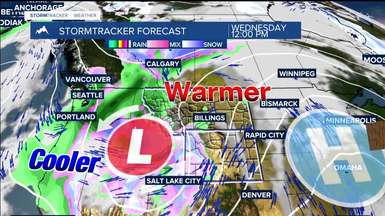
WEDNESDAY: THE TRANSITION: Temperatures midweek are tricky to forecast as it's a transition day, but expect highs generally in the 60s and 70s west of Billings, with 70s and 80s around and east of Billings. The day starts calm, but winds will pick up with gusts of 20 to 45 mph across south-central Montana and north-central Wyoming, strongest over the foothills west of Billings.
Fire weather risk peaks Wednesday due to these stronger winds, though the spring green-up will help limit potential impacts. Scattered showers and possibly a few thunderstorms may develop Wednesday afternoon and evening ahead of an approaching cold front.
THURSDAY THROUGH FRIDAY: A complex spring weather system brings dramatic changes. As a tight surface pressure gradient sets up, gusty winds become likely with a good chance of seeing 50 to 60 mph or greater gusts, particularly over eastern Montana and northern Wyoming.
The cold front's passage late Wednesday into Thursday increases precipitation chances to 70 to 90 percent across the area. However, recent model trends suggest the precipitation may end quicker Thursday as gusty northerly winds usher in cooler, drier air. There's a chance of seeing up to three-quarters of an inch of precipitation, with the highest amounts south of Billings over mountains and foothills where upslope enhancement occurs.
What starts as rain will likely turn to snow over lower elevations, with a moderate to high chance of this transition. The foothills and higher hills have a modest chance of seeing 3 or more inches of snow, while mountains could see 12 or more inches in a few higher peaks.
