



BILLINGS — THROUGH TUESDAY: With temperatures soaring into the 80s and 90s across the region, the heat will accelerate mountain snowmelt, causing area streams and rivers to rise significantly through the week. While flooding isn't expected at this time, the combination of higher flows and cold water creates hazardous conditions for anyone recreating near waterways.
May 25 record highs were tied or broken on Memorial Day in Billings, Baker and Miles City. Isolated showers and weak thunderstorms mainly across south-central Montana around and west of Billings will pop up through the evening. The main concerns are erratic winds gusting up to 45 mph along with occasional lightning strikes.
Tuesday continues to be hot for late May with highs in the 80s and 90s. More scattered showers and thunderstorms will generate over south-central Montana, plus isolated activity spreading into eastern Montana and north-central Wyoming.
Better moisture aloft creates elevated instability, though weak wind shear means storms will struggle to organize. The threats include erratic wind gusts up to 55 mph and brief moderate to heavy downpours. Wet microbursts could produce isolated wind gusts reaching 60 mph or greater.
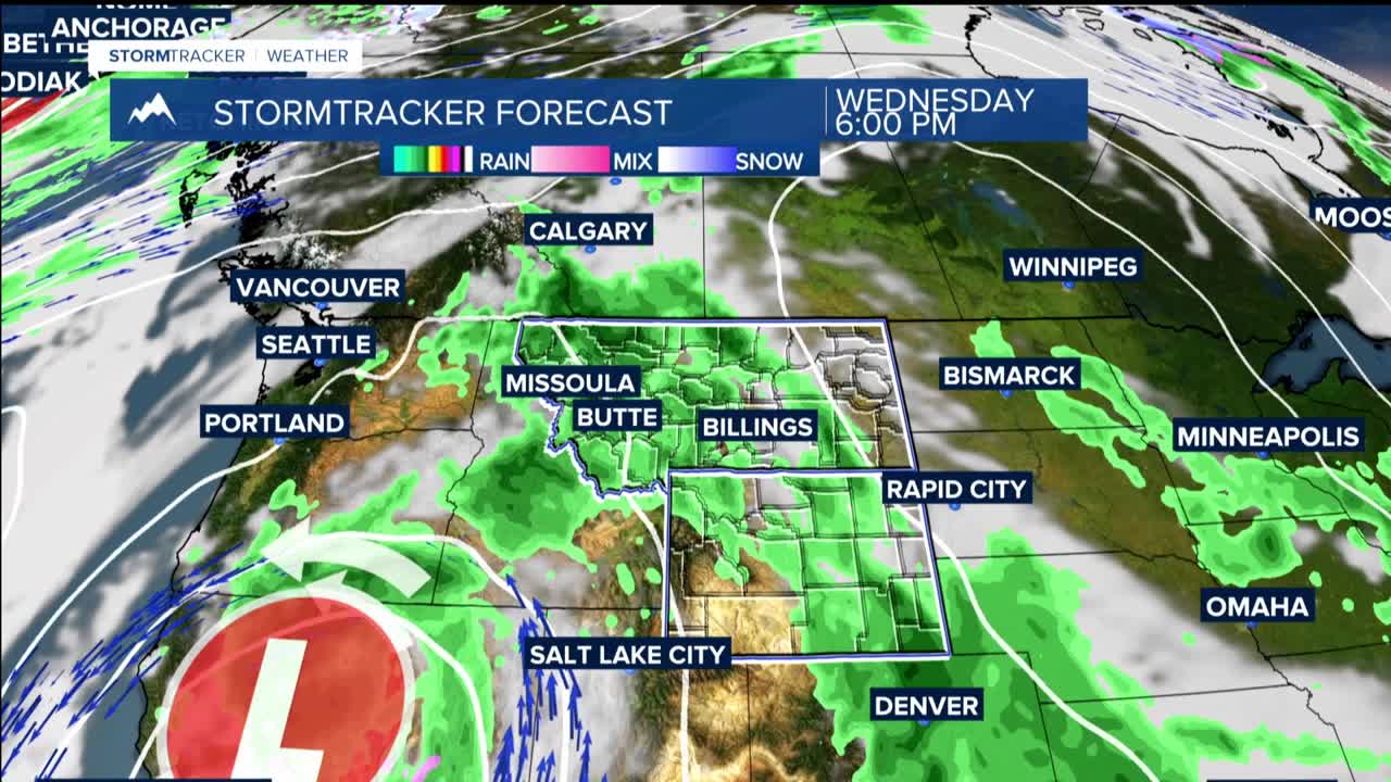
WEDNESDAY THROUGH THURSDAY: We trend slightly drier during this stretch, but isolated to scattered showers and thunderstorms remain in the picture, particularly around and west of Billings. The heat persists with daily highs continuing in the 80s and 90s, keeping mountain snowmelt active and river levels elevated.
FRIDAY THROUGH SUNDAY: Current models suggest a more favorable upper-level pattern for widespread precipitation and potentially strong to severe thunderstorms. However, uncertainty remains about the exact placement and strength of the approaching trough.
Saturday brings relief from the heat as high temperatures drop back into the 70s and 80s for the weekend. Unsettled weather continues into Sunday, though the chance of widespread precipitation and stronger thunderstorms gradually decreases.
Meanwhile, across far eastern Montana where precipitation chances are lower this week, windy southeasterly winds develop today and persist through the weekend. These gusts will vary between 20 and 40 mph, strongest near the Montana-Dakotas state line.
