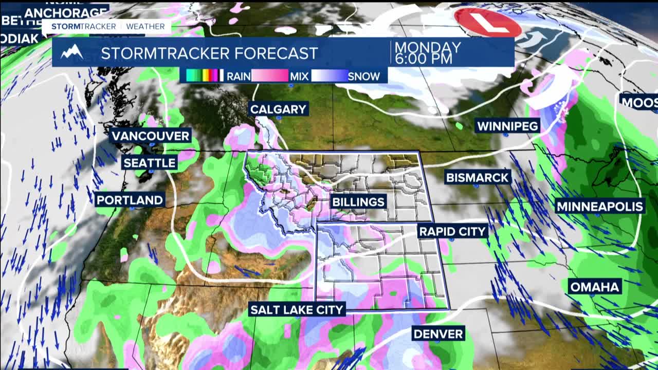


BILLINGS — THROUGH MONDAY: Light snow already developing with overnight temperatures in the upper 20s and lower 30s mean this snow will struggle to stick on pavement but could accumulate on grassy areas. Snow shifts eastward through Monday as a wave of energy approaches from the south, bringing rain changing to snow from late afternoon through tonight across the eastern plains.
Sheridan could see enhanced snowfall this evening. Winter Weather Advisories remain in effect for the Sheridan Foothills, Big Horn County, Southern Rosebud, and the Bighorn/Pryor Mountains with 1-4 inches expected and a 60% chance of seeing more than 2 inches.
Monday morning commuters should expect challenging conditions with slushy roads combined with areas of poor visibility. Billings is seeing its first measurable snow of April. This would break a streak dating back to March, as April without measurable snow has only happened 8 times since 1934.
The weather system exits Monday night, but cool and breezy conditions will be hazardous for young livestock through this period.
TUESDAY THROUGH WEDNESDAY: A northwest flow aloft keeps unsettled weather in the forecast despite afternoon temperatures warming into the 50s to near 60 degrees by the middle of the week. The warm up will trigger afternoon and evening showers Tuesday and again Wednesday, mainly near mountains and foothills.
Lower elevations will see rain, but freezing levels remain low enough to support graupel and small hail in heavier showers. By Wednesday, a few rumbles of thunder become possible as instability increases. Mountain areas will pick up several more inches of snow from these convective episodes over the two-day period.
THURSDAY THROUGH SATURDAY: Building high pressure brings warmer temperatures up to the 60s Thursday, then climb into the mid-60s to lower 70s Friday and Saturday under mostly dry conditions. There may be enough weak energy and lingering moisture to produce a few light showers.
NEXT SUNDAY: The ridge breaks down as another Pacific shortwave approaches, accompanied by cooler Canadian air. This brings a chance of showers and a return to cooler temperatures, setting up another potential weather change to start the following week.
