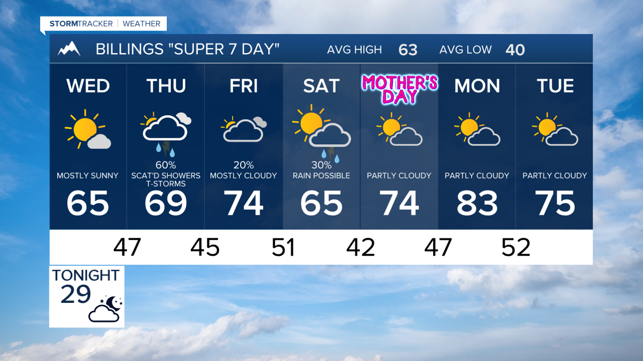

BILLINGS — THROUGH WEDNESDAY MORNING: Scattered showers across south-central Montana will gradually fade through this evening. Heavier downpours could briefly reduce visibility, especially for communities west and south of Billings where the atmosphere remains most unstable. 2 to 6 inches of fresh snow are possible onto north-facing mountain slopes. Even the Beartooth and Red Lodge foothills could see up to an inch of accumulation before dawn Wednesday.
Tonight brings the coldest air we've felt in a while, with temperatures dropping into the 20s and lower 30s. Time to cover those sensitive plants and bring in anything that shouldn't freeze.
WEDNESDAY THROUGH FRIDAY: An upper-level ridge begins building into the region, allowing sunshine to return and temperatures to climb back into the 50s and mid-60s Wednesday. Thursday, a shortwave disturbance around midday brings renewed chances for rain showers and scattered thunderstorms.
This will be the best opportunity for meaningful moisture over our central zones and mountain areas. Some locations could see at least a tenth of an inch of rain, with locally higher amounts possible where thunderstorms develop.
Friday briefly returns to quiet conditions, but it's short-lived.
WEEKEND INTO NEXT WEEK: The weekend forecast carries considerable uncertainty as models show an active system approaching late Friday and moving through Saturday and Sunday. While the exact strength and track remain unclear, this system has the potential to bring widespread showers and thunderstorms back to the region.
Temperature-wise, we're looking at a pleasant warming trend with highs climbing into the 60s and lower 70s Thursday through Sunday, then jumping into the 70s and 80s by Monday. Overnight lows will settle comfortably in the upper 30s to 40s most nights.
