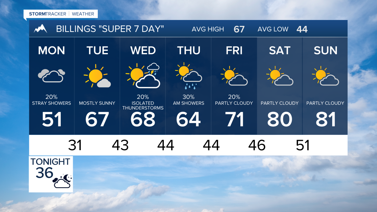


BILLINGS — TODAY THROUGH MONDAY: A disorganized storm system keeps things cool and breezy across the region through Monday. While this system has weakened compared to earlier forecasts, it's still bringing some impacts to higher elevations.
The Red Lodge and Beartooth Foothills above 5,000 feet will see light snow accumulations of 1 to 3 inches on grassy surfaces tonight into Monday morning, creating minor travel impacts. Mountain recreation could be affected by winter conditions as moderate snow continues in the higher terrain.
Winds remain breezy to windy with widespread gusts of 25 to 30 mph, and up to 40 mph near the mountains west and south of Billings. Most lower elevation areas will see very little precipitation...a tenth of an inch or less. Widespread frost and freeze conditions are likely both tonight and Monday night, with Monday night being the coldest. Make sure to protect any sensitive vegetation during this chilly stretch.
TUESDAY THROUGH SATURDAY: A gradual warming trend develops that lasts through the weekend. Temperatures climb back to near or slightly above normal with highs in the mid-60s to lower 70s through Friday with some work week showers possible.
Showers develop Wednesday afternoon and continue into Thursday, with area mountains and foothills having over a 40% chance of seeing a quarter inch or more of rain. Lower elevations west of Rosebud County have a chance of moisture. The mountains will see snowfall with this system .
Upper flow shifts westerly by Saturday, boosting temperatures into the upper 700s to 80s with plenty of sunshine to wrap up the forecast period.
