

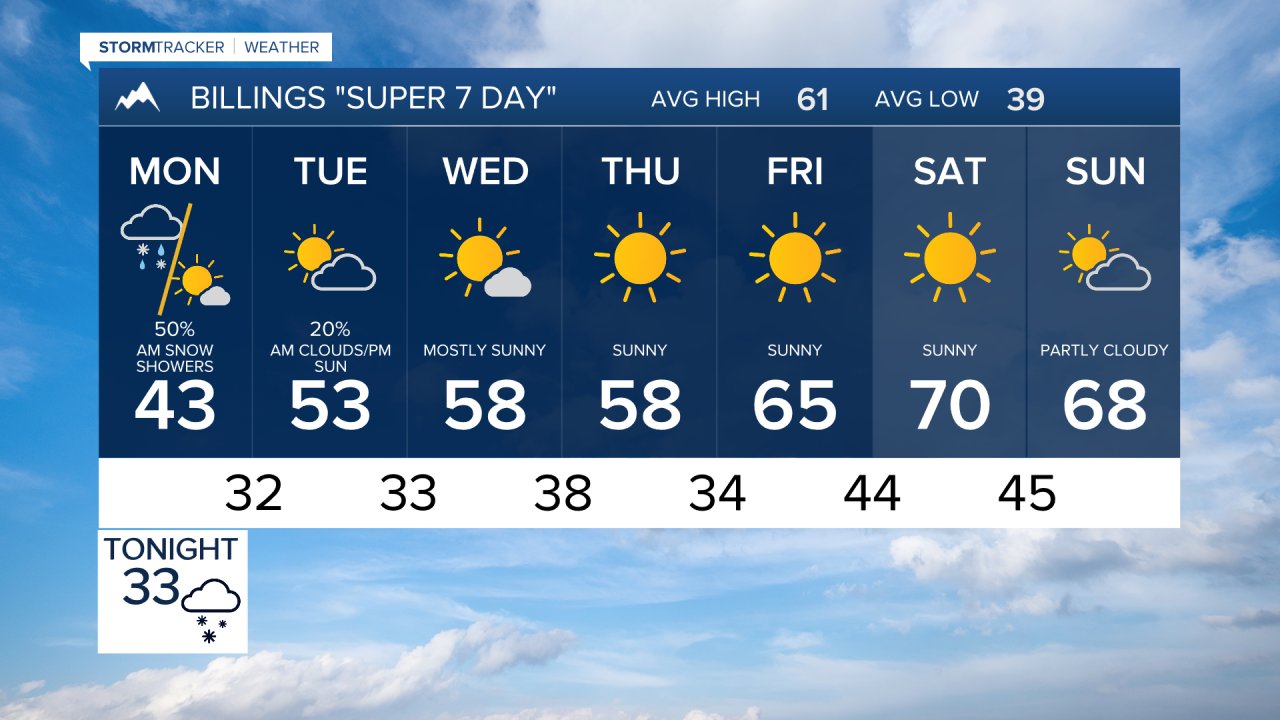


BILINGS — Rain and snow showers carry an 80% chance through this evening, with precipitation continuing overnight at near 90%. Keep the scraper handy and give yourself extra time on the roads tonight.
Precipitation eases through Monday morning, with chances dropping to around 35% by late morning, then clearing out by afternoon as highs only climb to the upper 30s. That's a brutal 15-20 degrees below the seasonal average for this time of year.
A Winter Weather Advisory and Winter Storm Warning are in effect for portions of the forecast area near Billings through midday Monday, with the mountains and foothills bearing the brunt of the snow. Tuesday warms to the lower 50s under mostly cloudy skies before conditions begin to improve, still running about 7 degrees below normal.
The extended pattern turns dramatically warmer by the end of the week. Friday reaches the mid-60s and Saturday pushes near 70°F, running 12 degrees above the October average. Wednesday and Thursday offer a pleasant transition with sunshine and upper 50s before that warmup arrives.
It's a classic Billings weather whiplash: winter storm to start the week, near-record warmth to close it.
