

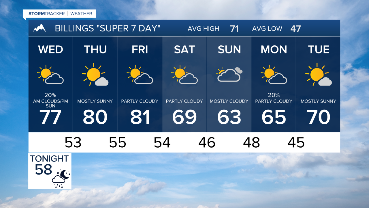

BILLINGS — A few scattered showers and thunderstorms will move through the region late today and tonight, followed by a stretch of warmer and mainly dry weather through the end of the work week. Temperatures will climb back into the 80s before another cooldown and a more unsettled pattern arrives this weekend and early next week.
TUESDAY NIGHT
Scattered showers and thunderstorms develop this evening and continue overnight. While severe weather is not expected, stronger storms could produce wind gusts around 40 mph along with pockets of brief heavy rainfall. Activity gradually diminishes toward Wednesday morning.
WEDNESDAY
A few lingering showers or storms may persist early, then skies become partly sunny through the afternoon. Temperatures remain seasonable with highs in the 70s. Conditions trend drier as high pressure begins building over the Northern Rockies.
THURSDAY
A pleasant fall day with mostly sunny skies and warmer temperatures. Afternoon highs reach the upper 70s to lower 80s across much of south central and southeast Montana, with dry conditions.
FRIDAY
The warmest day of the week. Highs climb into the upper 70s and lower 80s. Most locations remain dry, though a weak disturbance could trigger isolated showers or thunderstorms east of Billings during the afternoon and evening. Breezy southwest winds develop by late day.
SATURDAY
A cold front sweeps through the region, bringing noticeably cooler temperatures. Highs fall back into the 60s and lower 70s. Most areas remain dry, but breezy to windy conditions are expected with gusts frequently reaching 20 to 35 mph, especially across open areas and higher terrain.
SUNDAY
The weather pattern becomes more active again. Expect increasing clouds with scattered showers and a few thunderstorms possible. Temperatures stay cooler, generally in the 60s.
MONDAY
Unsettled conditions continue with periodic chances for showers and thunderstorms. Daytime temperatures remain near to slightly below seasonal averages, mostly holding in the 60s across the region.
Overall, after tonight's scattered showers and storms, expect several pleasant and warmer days through Friday before a weekend cold front brings cooler temperatures, gusty winds, and a return to more unsettled weather into early next week.
