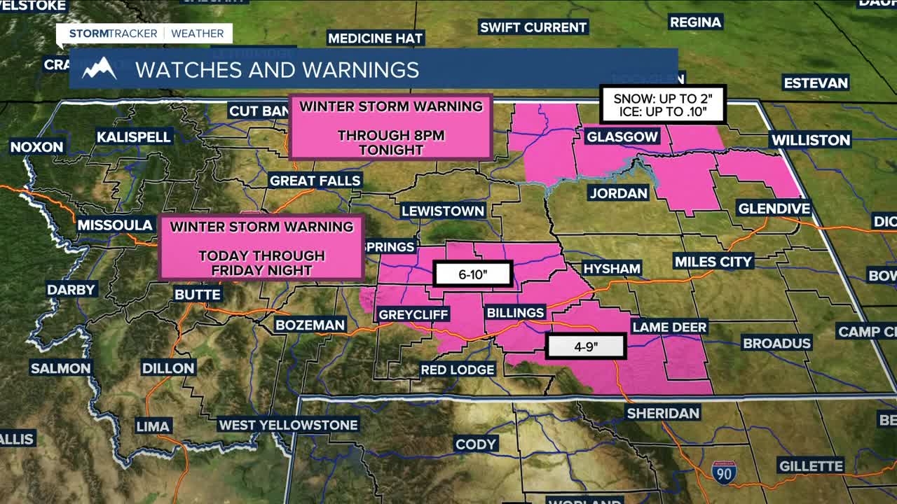


BILLINGS — A strong winter system is moving in tonight and will impact much of the area through Saturday morning. A WINTER STORM WARNING is in effect from 5 PM Thursday to 8 PM Friday for south-central and southeast Montana, including Billings, Big Timber, Columbus, Hardin, Crow Agency, Lame Deer, Ashland, Lodge Grass, Laurel, Absarokee, Park City, and surrounding communities. Snow totals of 4–9 inches are expected, with the highest amounts north and east of Columbus, while winds up to 35 mph will reduce visibility and make travel hazardous.
Meanwhile, a WINTER WEATHER ADVISORY is in effect from 5 PM Thursday to 5 AM Friday, calling for up to 1 inch of snow with winds up to 30 mph. A WINTER STORM WATCH is also in effect late Thursday through Saturday morning, with an additional 5–9 inches of snow possible.
Based on current projections, snow totals could reach: Billings 4–11", Livingston 0–T, Miles City 2–10", Sheridan 1–5", Red Lodge 0.5–4", Big Timber 1–8", Alzada 3–9", Baker 1–7", Broadus 2–8", Columbus 1–8", Cooke City 2–13", Crow Agency 6–12", Ekalaka 1–8", Gardiner 0", Harlowton 4–10", Hysham 4–10", Lame Deer 5–12", Lodge Grass 4–10", Roundup 3–10".
These totals could still change, but confidence is high that significant snow will impact travel and daily activities. Stay weather-aware, prepare for slick roads, and stay safe over the next few days!
Temperatures on Friday and Saturday will be much colder, mostly in the single digits and teens. Foothill highs are currently expected to be warmer in the 30s and 40s, although some models push cold air farther west, so temps could turn colder.
By Sunday into early next week, ridging builds in and we warm and dry out again.
Miller Robson
Q2 Morning Meteorologist
miller.robson@ktvq.com
