

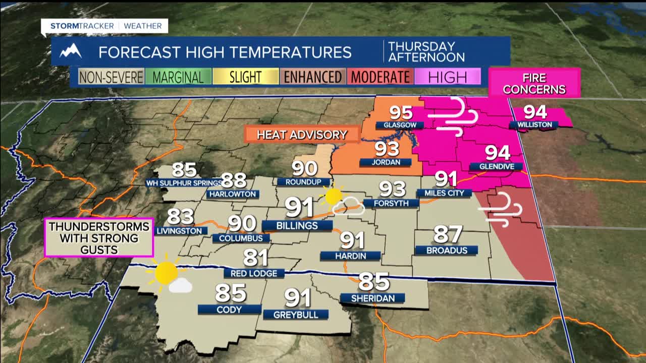


BILLINGS — TODAY THROUGH FRIDAY: The heat is on as temperatures climb into the 80s and 90s through Friday. Eastern areas will feel the brunt of this heat wave, with the warmest conditions expected there. This persistent heat will accelerate mountain snowmelt, causing river flows to increase, though no flooding is anticipated at this time.
Daily thunderstorm chances will dot the forecast through the end of the work week, but the best opportunities for showers and storms will favor south-central and western Montana, along with north-central and western Wyoming. These storms could pack a punch with gusty winds up to 50 mph and brief moderate rainfall, but most areas will stay dry.
Breezy conditions develop east of Billings, where daily wind gusts between 20-40 mph are possible through Thursday. By Friday, these gusty winds will shift toward the Dakota border as weather patterns adjust.
SATURDAY THROUGH TUESDAY: A low pressure system moves through the Great Basin and into our region. This change will flip us from hot and mainly dry to cooler and much more active.
Saturday, temperatures drop to the upper 60s and 80s as shower and thunderstorm chances increase significantly to 50-90%. The cooling trend continues Sunday through Tuesday, with highs falling into the 60s and 70s .
The storm chances remain through early next week, with western and central areas having the highest probability of seeing meaningful rainfall. Current forecasts suggest a 40-80% chance of receiving at least half an inch of precipitation from Saturday through Monday, mainly to the west and north of Billings.
