

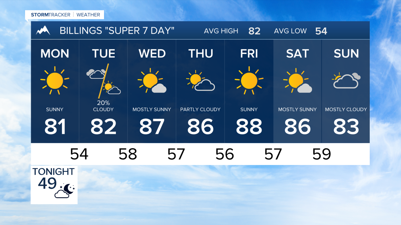


BILLINGS — Daily thunderstorm chances return beginning Tuesday, but forecast confidence decreases later in the week as a large Pacific Northwest storm system evolves.
SUNDAY
Behind today's front, Billings, Livingston, Big Timber, Red Lodge, Sheridan, and surrounding areas will see increasing west winds gusting 25 to 40 mph through early evening. Skies gradually clear tonight with cooler overnight temperatures, including 30s in the mountain valleys and around 50 degrees across the lower elevations.
MONDAY
Sunshine will dominate with dry conditions and warmer temperatures. Afternoon highs climb back into the 80s for most locations. Northwest winds may remain a bit breezy over southeast Montana during the morning but ease through the day.
TUESDAY
Cloud cover increases as the next disturbance approaches from the Great Basin. Temperatures continue warming into the 80s to near 90 degrees around Billings and much of the Yellowstone Valley. Isolated to scattered afternoon and evening showers and thunderstorms are possible, with the better chances near the Beartooths, Bighorns, Pryors, and along the Montana-Wyoming border. Most areas remain dry much of the day, but any storm could produce brief gusty winds and lightning.
WEDNESDAY
This is the day with the greatest potential for more widespread weather impacts, though uncertainty remains high. Temperatures reach the upper 80s to lower 90s ahead of developing storms. A stronger disturbance could move into the Northern Rockies, resulting in broader shower and thunderstorm coverage across Billings, south central Montana, southeast Montana, and northern Wyoming. A few storms could be strong to severe if this scenario develops.
THURSDAY
Temperatures stay above average, generally in the 80s to lower 90s. Not everyone will see rain, but scattered storms remain possible across much of the region. Forecast confidence remains only moderate as weather details will depend on the exact position and strength of the Pacific Northwest upper low.
FRIDAY
Southeast low-level winds may draw additional moisture into the area, supporting another round of scattered afternoon and evening thunderstorms. Some storms could become stronger due to increasing wind shear aloft. High temperatures remain in the 80s to near 90 degrees around Billings, Sheridan, and Miles City.
SATURDAY
The Pacific Northwest storm system may begin moving closer to Montana and Wyoming. If this occurs, shower and thunderstorm coverage would increase across the region while temperatures begin a gradual cooling trend. While details remain uncertain, the overall pattern favors more numerous precipitation chances heading into the weekend. Anyone with Labor Day weekend outdoor plans should stay alert for forecast adjustments throughout the week.
