

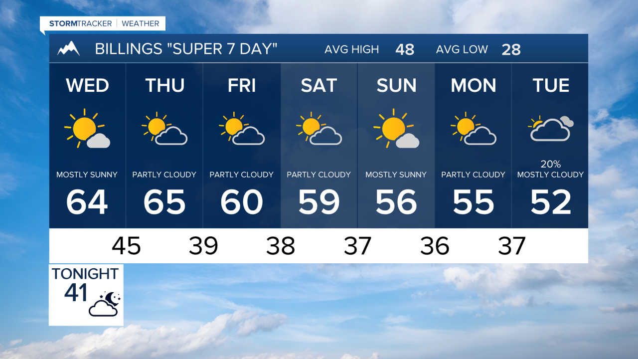

BILLINGS — A stretch of unusually warm and mostly dry November weather settles in through the weekend. A turn toward cooler and potentially more unsettled conditions is possible early next week.
TUESDAY EVENING
Winds gradually decrease late in the day and evening. Lows will be mild for mid-November in the 30s to low 40s. Expect a partly cloudy overnight sky.
WEDNESDAY
High pressure begins building across the region, starting an extended stretch of warm and dry weather. Sunshine and much lighter winds are expected for most locations, with highs climbing into the lower to middle 60s across much of south-central Montana and northern Wyoming.
THURSDAY
Warm and dry conditions continue. High temperatures will again reach the 60s in many areas, including around 65 degrees at Billings and Miles City and near 69 around Sheridan. These readings are well above normal for mid-November.
FRIDAY
The mild November pattern holds with another dry day expected. Afternoon temperatures should generally reach the upper 50s to middle 60s across southern Montana and northern Wyoming.
SATURDAY
Mostly dry and unseasonably mild weather continues into the first half of the weekend. Highs remain mainly in the upper 50s and 60s, although temperatures may begin easing slightly along the western foothills as the persistent ridge starts to weaken.
SUNDAY
The weather pattern begins showing signs of change as the ridge breaks down and a trough approaches the western United States. Much of the area should remain mild, with highs generally in the upper 50s to lower 60s, but a few showers could begin developing near the western mountains and foothills.
MONDAY
Cooler and potentially more unsettled weather becomes possible as lower pressure builds into the region. Highs are expected to fall mainly into the 50s, with increasing chances for precipitation, particularly toward the western mountains and foothills. Forecast confidence decreases by this point, but the overall pattern favors a transition away from the prolonged warm and dry stretch.
