

BILLINGS — THROUGH SUNDAY NIGHT: Thunderstorms pack a punch with gusty winds capable of reaching 30 to 50 mph. Unlike Saturday's mostly dry and windy storms, these have better moisture to work with, meaning actual precipitation reaching the ground. Areas lucky enough to get under a thunderstorm have been picking up a tenth or two of rainfall, though most spots will see lighter amounts.
MONDAY: Gusty west to southwest winds from late tonight through Monday with speeds reaching 40 to 50 mph manly west of Billings. Livingston, Big Timber and Harlowton could all see stronger gusts.
Another round of scattered showers and isolated thunderstorms develops Monday afternoon and evening, with the best action east of Billings where precipitation chances climb to 30-50%. Western areas stay drier thanks to those downslope winds, but everyone should watch for isolated thunderstorms packing gusty winds. High temperatures are into the 55-65 degree range.
TUESDAY: Downslope winds keep us relatively dry with the best precipitation chances staying in the mountains. Temperatures rebound nicely with most areas climbing back into the mid-60s. A relatively quiet day.
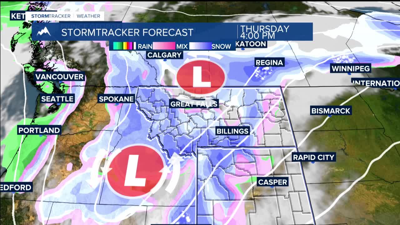
WEDNESDAY THROUGH FRIDAY: A much stronger and colder storm system makes its entrance late Wednesday, dropping southeast from southern British Columbia into Idaho and western Montana. Snow levels drop down to 4,500 feet by Thursday morning and bottoming out at 3,500 feet by Thursday evening, meaning even Billngs could see snow or a rain/snow mix.
Thursday night into Friday morning brings the potential for accumulating snow even in lower elevations, with 3+ inch probabilities around 50% for Livingston, Big Timber, and Sheridan, and about 25% for Billings and Hardin. Mountain locations face a potential weather assault with heavy snowfall. The Beartooth and Absaroka mountains could see over a foot of snow while the Crazy Mountains and Bighorns will probably see less.
Wednesday's pleasant 60-something to lower 70s temperatures slip into the 40s and 50s Thursday, with western foothills potentially dipping into the upper 30s. Friday stays chilly in the 35-45 degree range with plenty of clouds and ongoing precipitation.
NEXT WEEKEND: Ridging builds back in, bringing drier and warmer conditions. Saturday temperatures recover into the 45-55 range, then climb into the 55-65 range for Sunday.
