

BILLINGS — THROUGH WEDNESDAY: After a warm start, mainly in the 40s, Tuesday will reach the upper 70s and 80s. Wednesday warms to upper 70s and 80s around and east of Billings to near 90 in the eastern plains. But cooler upper 60s to 70s west of town as changes begin.
This early-season heat will accelerate mountain snowmelt, especially at mid-levels where overnight lows stay near or above freezing tonight and Tuesday night. While flooding isn't expected, streams and rivers will see noticeable rises. Use extra caution around waterways.
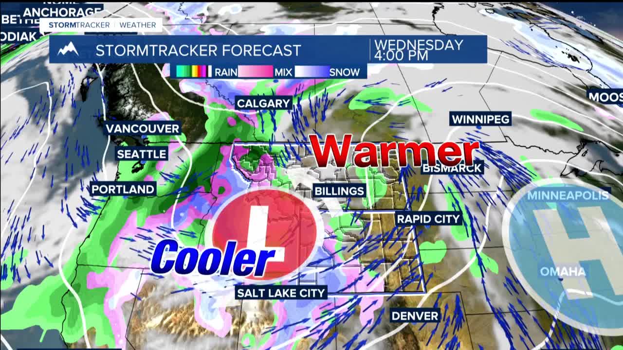
Fire weather concerns remain manageable Tuesday with lighter winds, though occasional daytime gusts could reach over 20 mph. Wednesday, southwest winds increase ahead of an approaching cold front bringing gusts of 20 to 40 mph, especially over the foothills west of Billings. Combined with single-digit to teen relative humidity values, fire danger will spike Wednesday despite ongoing spring greening limiting grass fire risk in some areas.
A subtle disturbance late Tuesday could trigger isolated showers with a 10 to 20 percent chance, but dry surface air will likely evaporate most precipitation before it reaches the ground. The main threat from any shower activity would be brief gusty and erratic winds.
WEDNESDAY EVENING THROUGH FRIDAY: While significant uncertainty remains about exact details, strong winds, widespread precipitation, and sharply colder temperatures are all expected.
Late Wednesday into early Thursday as a cold front pushes through, precipitation chances jump to 50 to 90 percent depending on your location. Wednesday afternoon and evening, thunderstorms are possible over the plains, with gusty and erratic winds as the primary threat.
Thursday becomes the wild card as models show a large low-pressure system developing over the high plains before potentially phasing with another system dropping from the northwest on Friday. This could either stall the low over the Dakotas, bringing higher impacts to our area, or shift it north into southern Canada, limiting local effects.
Wind gusts may reach 60 mph or greater on Thursday, with the highest probability over far eastern Montana and north-central Wyoming. The chance of receiving a quarter to half an inch or more of precipitation from late Wednesday through Friday is greatest over the foothills and high hills south of Billings.
Precipitation will likely start as rain before potentially switching to snow on Thursday. Eastern Montana deserves special attention, as a quick switch from rain to snow could cause blowing snow.
THE WEEKEND AND BEYOND: UNSETTLED PATTERN CONTINUES
The weekend maintains an unsettled weather pattern with cooler temperatures and occasional precipitation chances.
