

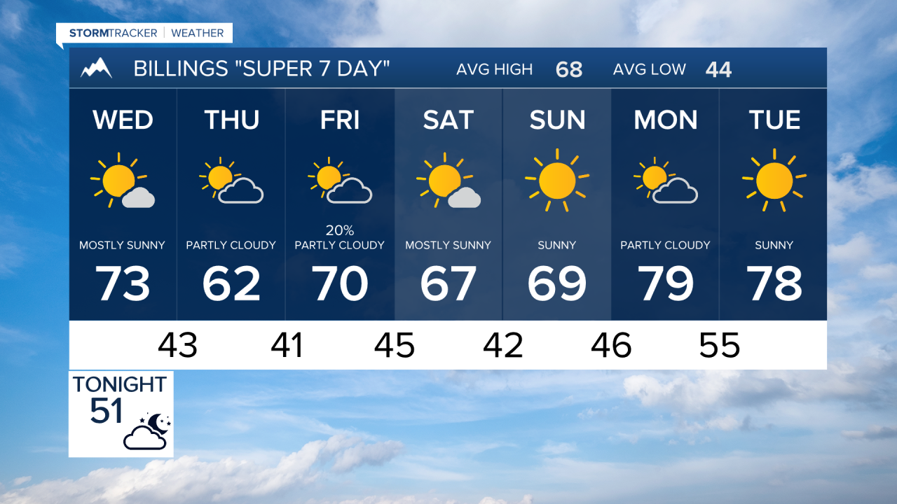

BILLINGS — Mild and mostly dry weather will dominate the next week, with a brief cooler and somewhat unsettled stretch Thursday before warmer temperatures return for the weekend and early next week.
TUESDAY NIGHT
Breezy westerly winds will gradually ease tonight after gusts of 25 to 35 mph across much of the region during the day. Skies will remain partly to mostly cloudy at times, with dry conditions prevailing.
WEDNESDAY
A Canadian cold front moves through during the afternoon. Winds will remain breezy and gradually turn from northwest to northeast. Temperatures will be several degrees cooler but still a little above normal. The frontal passage itself should remain dry.
WEDNESDAY NIGHT
Cooler and somewhat more humid air settles into the region behind the front. A few light showers may develop, especially across northern and eastern areas. Increasing low-level moisture could also produce areas of low clouds or fog.
THURSDAY
This will be the coolest day of the stretch, with highs generally in the upper 50s to middle 60s. Periods of light showers remain possible, particularly across northern and eastern portions of the region. Low clouds could also linger in some areas.
THURSDAY NIGHT
Any lingering light showers should remain focused primarily across northern and eastern areas. Otherwise, expect a cool night with clouds gradually becoming less of a factor.
FRIDAY
A quick warm-up returns as downslope winds develop. Highs rebound into the middle 60s to middle 70s with mainly dry conditions during the day. Another Canadian cold front approaches Friday night.
SATURDAY
Temperatures turn modestly cooler behind the front. Most locations should remain dry, although a brief light shower cannot be ruled out across northern and eastern areas.
SUNDAY
High pressure strengthens across the northern Rockies, beginning another warmer and predominantly dry stretch. Temperatures should climb back above normal.
MONDAY
Warm and dry weather continues under a strong western ridge. Some locations could approach or reach the lower 80s as temperatures rise well above early-October averages.
TUESDAY
The warm and dry pattern holds, with lower 80s again possible in the warmer locations. Longer-range indications continue to favor warmer and drier than normal conditions beyond this period.
