

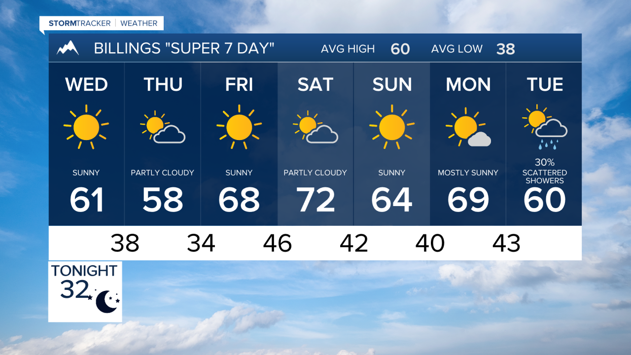

BILLINGS — A cool stretch continues through Thursday, with a few mountain showers, areas of fog, and some strong winds over far eastern Montana. Then the pattern flips warmer and drier heading into the weekend, with 60s and 70s returning.
TUESDAY NIGHT
Showers gradually shift to the east while areas of fog develop across portions of the region. Some of that fog could become locally dense, significantly reducing visibility. Temperatures will fall to near or below freezing in many locations to the 20s to low 30s.
WEDNESDAY
Temperatures rebound closer to seasonal averages reaching more 50s to low 60s by the afternoon. Most of the region remains dry, although a slight chance of rain or snow shifts into far southeast Montana and northeast Wyoming during the afternoon and evening. A dry cold front moves through Wednesday night, bringing precipitation chances to an end.
THURSDAY
Behind the front, temperatures turn a little cooler again. Winds across far eastern Montana could gust to 40 to 50 mph. Elsewhere, gusts generally stay in the teens and 20s mph. Another cold night follows Thursday with temperatures near or below freezing.
FRIDAY
High pressure begins building into the region, starting a warmer and drier stretch. Temperatures climb above normal, although winds will increase at times. The strongest winds begin developing around Livingston and Nye late Friday.
SATURDAY
Saturday looks like the warmest day of the stretch, with widespread 60s and 70s. Dry weather continues, but it could become quite windy around Livingston and Nye ahead of another dry cold front arriving Saturday night.
SUNDAY
The cold front passes early, but the overall weekend pattern remains generally dry.
MONDAY
Monday looks mainly dry and warm. Another weather system may begin affecting the region around Tuesday or Wednesday of next week.
